Outdoor Links
Hike Arizona
Trip Planning Guide
Trip Report Index
Calendar of Events
Library
|
La Barge Canyon Day Hike Superstition Wilderness December 8, 2018 by Tamar Gottfried |
|
 Tamar, Michael, Ken, Carolyn, Terry, Dave, Pete in back. Moé, Li, Tom, Kelly, Janet in front. (Ralph not pictured). |
|
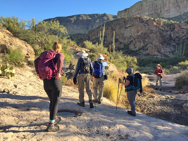
Lucky number 13 Trailblazers assembled at the First Water Trailhead and hit the trail at 7:20 AM, ready for a day of adventure. The air was cool and fresh after a few days of rain and had a nice aroma of chaparral. We didn’t see much water in any of the washes as we ascended to Garden Valley and the ruins at the intersection with the Black Mesa Trail. After taking a moment to appreciate the views in back of us, we continued along the Second Water Trail. We noticed a brand new trail sign indicating the way to Hackberry Spring. Then we descended into the riparian zone of second water and finally saw some little pools of still water, as well as trees with multi-hued leaves and verdant shrubbery. |
 The Second Water Trail goes by Black Mesa. [photo by Ralph] |
|
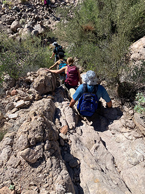
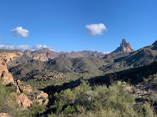
Next up, the first views of Geronimo Head and Battleship Mountain. After a quick stop at Indian Paint Mine, we descended into the dry creek bed and started the off trail portion of our day. A slow slog on large and small river rocks changed our pace. The rocks grew larger and larger, until we reached a spot where we had to climb some huge boulders to reach the opening to Labarge Box. Everyone arrived unscathed. |
 Geronimo Head and Battleship Mountain are ahead. [photo by Ralph] |
 Approaching Boulder Creek. [photo by Li] |
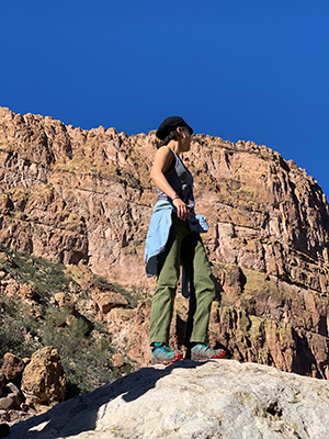 Moé has an excellent view. [photo by Ralph] |
 Climbing the boulders. [photo by Ralph] |
 It gets plenty steep. [photo by Kelly] |
|
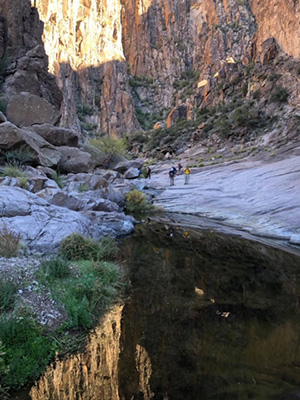
It was a thrill to walk on the slickrock floor and behold the tall walls of the canyon and the deep clear pools. We took a longer break to eat lunch, explore, listen to a little harmonica music courtesy of Moé, and to take our amazing group photo (minus Ralph, our photographer of the moment). It was cool enough in the Box that the jackets, which we had quickly shed in the early morning, had to come back into service. The jackets didn’t last long after we resumed our hike. Next up was a steep climb out to the saddle, followed by a quick descent. The last part required some butt-sliding. |
 Ralph pauses reflectively. [photo by Li] |
 Quiet reflections in a pool. [photo by Ralph] |
 Cliffs tower above us. [photo by Ralph] |
 Michael takes a picture. [photo by Kelly] |
 Quiet reflections in a pool. [photo by Kelly] |
 The canyon bottom is slickrock. [photo by Li] |
 Beginning the climb out. [photo by Li] |
 Watch your step! [photo by Ralph] |
 There is a trail, of sorts. [photo by Ralph] |
|
We intersected the Boulder Canyon Trail and followed it as well as we could (not an easy task), in and out of the creek bed and along the sides. At one point, we couldn’t find the trail. A few of us took off in another wash until Michael called us back. He had located the trail. Dave and Ralph decided to bushwhack to the intersection with the Dutchman’s Trail, and no sooner had we found the Dutchman’s, we found them. After a brief respite at the intersection of the Black Mesa Trail with the Dutchman’s we began the last leg of our journey: 4+ miles back to Fiirst Water Trailhead. At least this trail is easy to follow! |
 Weaver’s Needle from the Dutchman’s Trail. [photo by Ralph] |
|
By 4 PM we all reached the cars, and after a snack and drink break went our separate ways. Our GPS mileages didn’t agree, ranging from 13.8 to 18.3 miles, but we all agreed that it had been a tough, long and beautiful day in the wild Superstitions. |
 Top of Page
Arizona Trailblazers Hiking Club, Phoenix, Arizona
Comments? Send them to the AZHC .
updated December 10, 2018