Outdoor Links
Hike Arizona
Trip Planning Guide
Trip Report Index
Calendar of Events
Library
|
Kelsey-Dorsey Loop Sycamore Canyon, Coconino National Forest October 20, 2018 by Chuck Parsons |
|
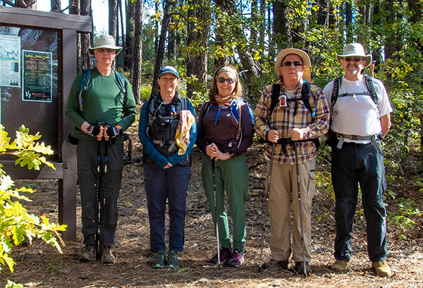 Five Arizona Trailblazers are ready to hit the trail. [photo by John] |
| Terry, Jane, Mary, Chuck, John |
|
Just driving to the Kelsey Trailhead is somewhat of an adventure in itself, since it involves driving nearly 21 miles of Forest Service roads out to the trailhead. From Historic Route 66 in Flagstaff, we turn off onto Woody Mountain Road (FR231). The first couple of miles are paved and in great shape before we finally hit the dirt. But the dirt portion of FR231 is also in good shape and kept well graded. After 13.7 miles of driving FR231 we turn right onto FR538. This forest road is also in pretty good shape, and we drive that for another 5.3 miles before making another right turn onto FR538G. And this is where the going gets a lot tougher, separating the serious off-roaders from the rest of the pack and putting vehicle suspension systems, as well as passengers, to the ultimate test. But we Arizona Trailblazers have certainly seen our share of extremely rough and primitive Forest Service roads over the years, some that don’t even resemble a road as we normally think of one, and would actually be more suitable for a half-track or perhaps even a Bradley tank. After a few miles on these so-called “roads”, kidneys and bladders have been jostled and jarred to the point where all vehicles are forced to stop from time to time to allow long-suffering passengers and drivers time to bail out and get up close and personal with nearby trees and bushes as quickly as possible. |
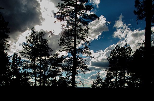
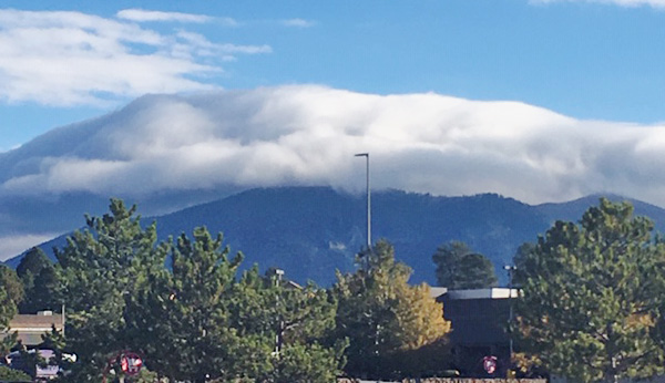 A thick layer of altostratus clouds hangs over the Mt. Elden area. [photo by Jane] |
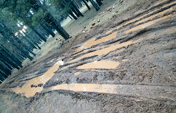 This is just one of numerous muddy, water-filled stretches of FR538G. [photo by John] |
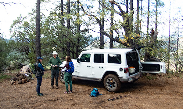 We finally reach the Kelsey Trailhead. [photo by John] |
|
Bladder Buster. Kidney Crusher. Road to Hell. These are just a few of the more colorful terms used by both drivers and passengers to describe some of these roads. The one-mile stretch of FR538G obviously hasn’t seen any sort of maintenance whatsoever in the past ten years or more and definitely qualifies as a Bladder Buster road. With John’s Jeep JL bouncing and swaying violently and erratically over large boulders, 8-10" high ledges and drop-offs, and deep water-filled craters across the road, suspension systems groan and protest under such extreme punishment and passengers are tossed and slammed about like crash dummies. I hang on for dear life in the shotgun position, while in the back, Mary, Terry, and Jane firmly link arms to minimize the merciless swaying and bouncing, as we slowly and painfully creep along on this bladder-busting Road from Hell. Meanwhile, at the wheel John jams his foot down hard on the accelerator, wheels spinning and mud flying in all directions, as he lets loose a strange diabolical laugh and continues to test the JL to its limits. Some of us may be wondering by now if the Jeep is going to make it to the trailhead in one piece before breaking down or breaking apart and scattering its iron and steel innards along the road, as we carom along to an unknown destiny. At any moment now we expect to see broken down and abandoned vehicles pushed off to the side of the road. We also have to wonder if any tow truck driver would be bold or foolish enough to even attempt to come out here and pick up the remains. Jumping Jehoshaphat! Just how much longer can we endure such punishment? Miraculously, by 10:00 AM we finally reach the trailhead. And it’s a race for the trees, as we waste no time bolting from the Jeep and running desperately like wild turkeys trying to evade the Thanksgiving ax for the biggest trees we can find. Let’s keep it decent, people, so it’s boys to the left side of the road and girls to the right side. Oh, mercy—what sweet relief! And thankfully not a single bladder or kidney has exploded on the drive. The hike today should be relatively easy by comparison to the drive, or at least one would think so. |
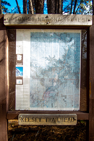 The official NFS Kelsey Trailhead sign. [John] |
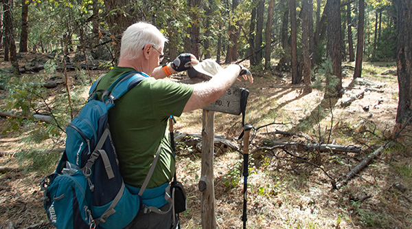
 Trailblazers pause for a quick break. [John] |
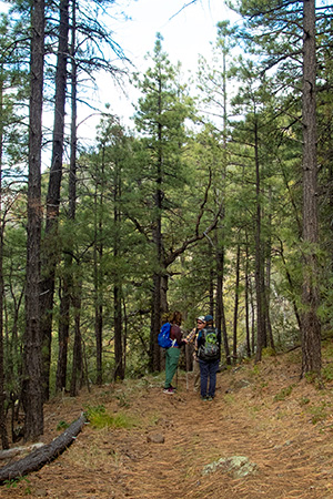
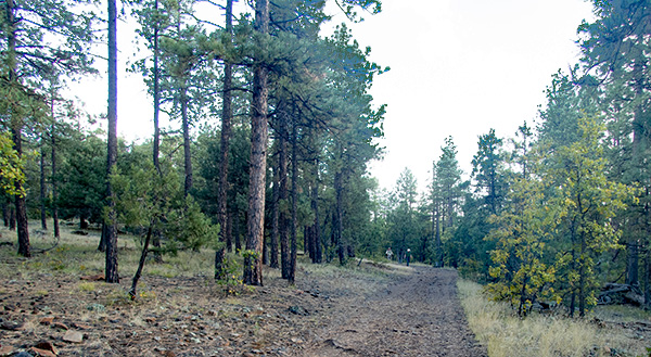
 Arizona Trailblazers begin the descent on the Kelsey Winter Trail. [photo by John] |
|
Under partly cloudy skies and a perfect hiking temperature of 60 degrees, we start the hike at 10:20 AM on a beautiful Saturday morning in northern Arizona’s canyon country. At least this time we’re getting a 40-minute earlier start than we did on our August, 2014, hike, when we had to park a full half-mile short of the trailhead because our vehicles simply couldn’t handle any more of the tough and challenging FR538G. Thanks to John’s rugged and trustworthy Jeep JL, we are able to make it all the way to the trailhead this time. I sign us in on the official Forest Service trailhead register book, and we begin descending right from the start into Sycamore Canyon on the rough and rocky Kelsey Winter Trail. |
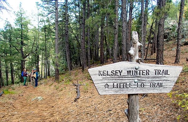
 Terry preps one of the trail signs for a picture. [photo by John] |
|
I’ve been undergoing physical therapy on my bad right knee for the past six weeks, so the going is especially slow for me on these steep, downhill stretches of rocky trail that are tough on anyone’s knees. We had a large contingent of 18 hikers on our 2014 hike, and as usual with such a large group we quickly became scattered over a larger and larger stretch of trail. With only 5 hikers today, we’re able to stay more closely together for most of the hike. And especially for the hike leader it’s much easier to keep track of a smaller group of hikers. 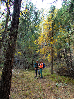 Jane and Mary take time for a quick picture break. [photo by John] This is a rugged, isolated, and seldom-visited area, accessible only by foot or by horseback. It represents a truly unique hiking experience in Arizona. Sycamore Canyon is 21 miles long and 7 miles in width at its widest point, second only to the Grand Canyon in size and scope. This was the first place in Arizona to be designated a Primitive Area, later changed to a Wilderness Area under the 1984 Arizona Wilderness Act. And just as Oak Creek to the east slowly cut its way over millions of years into the Mogollon Rim to create what we know today as Oak Creek Canyon, Sycamore Creek similarly carved its way deep into the rim to create Sycamore Canyon. These two canyon systems represent the two largest within Arizona’s Red Rock Country. |
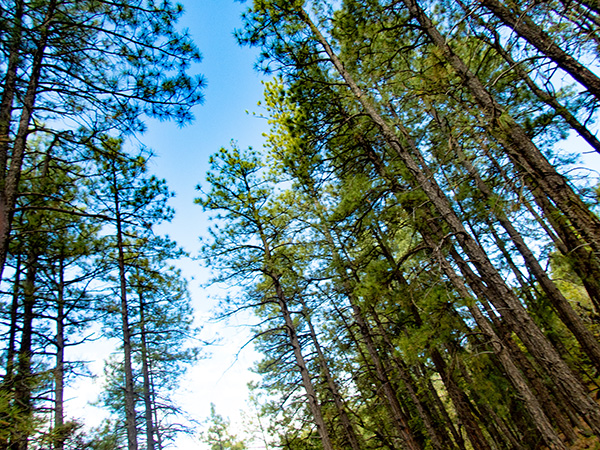 Tall pine trees soar high into the Arizona sky. [photo by John] |
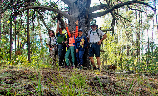 We pose by one of the largest alligator junipers we’ve ever seen. [photo by John] |
|
The Kelsey-Dorsey Loop trail consists of the Kelsey Trail and the Dorsey Trail, forming a 7.5-mile loop. We continue following the Kelsey Trail west past Kelsey Spring and then southwest through a forest of large ponderosa pine and juniper, including a number of huge alligator junipers, some of the largest in Arizona. The trail levels off for a while before continuing in a more gradual descent and eventually swinging sharply to the northwest. We finally reach Babes Hole Spring and then the junction with the Dorsey Trail, about three mile from the trailhead. We make a sharp left turn here, heading south and then southwest on the Dorsey Trail through a mixed forest of ponderosa pine, oak, juniper, manzanita, and holly. In geological terms this part of the Dorsey Trail is known as a bench, or a broad open plateau that sits between the upper and lower rims of Sycamore Canyon. Our next stop is Dorsey Spring at the southwest corner of the loop, about 1.6 miles ahead. |
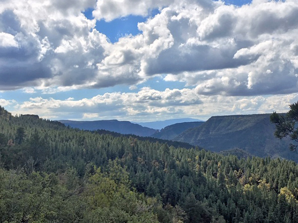
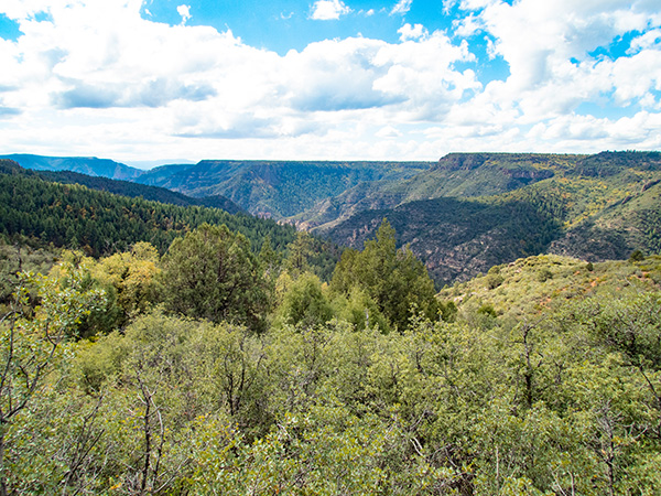
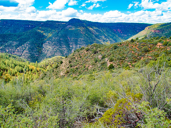 View looking deep into colorful Sycamore Canyon. [photo by John] |
|
But before we go that far, we decide to take time out for a lunch break. It’s already past 11:30 and most of us are beginning to get hungry, so we find a large log with a view to rest on while we take a well-deserved lunch break. So far we haven’t run into any other hikers on the trail, which was the case on our 2014 hike as well. After lunch we continue on our journey south to Dorsey Spring. This section of the Dorsey Trail alternates between pine-juniper forests on the cooler and wetter northwest-facing slopes and chaparral and scrub oak on the sunnier and drier southwest-facing slopes. And it’s here along these chaparral-covered slopes that we get our best views looking deep into Sycamore Canyon since there are no tall pines to obstruct the view. |
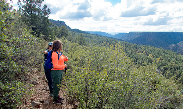 Mary and Jane check out the canyon views. [photo by John] |
 Spectacular cumulus clouds hang over Sycamore Canyon. [photo by Jane] |
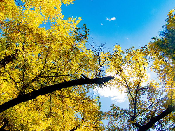
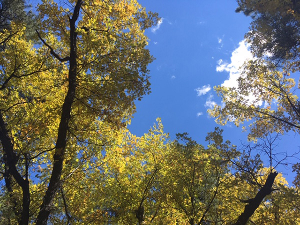 The beautiful fall colors of Sycamore Canyon. [photo by Jane] |
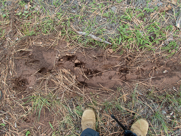
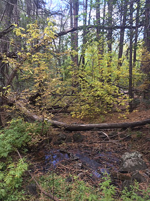 Dorsey Spring is a little dry on today’s hike. [Jane] 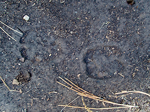 We see many deer and elk tracks. [John] |
After soaking in the great views at several rim overlooks and taking many pictures, we move on and eventually reach Dorsey Spring at the southwest corner of the loop. Of the three springs encountered on this loop hike, Dorsey Spring is normally the most picturesque and inviting, with its shimmering pools of water, lush green grasses, flowering plants and small scrubs—a mini oasis in a forest of tall pines, junipers, and oaks. But unfortunately, not today. Instead, the spring is quite a bit drier than it was on our 2014 hike, and the lush green grasses and flowers have long since faded away on this cool fall day in late October. We leave Dorsey Spring behind and continue hiking east on the Dorsey Trail. When hiking this loop in a CCW direction like we are today, you need to make a left turn before the spring. The spur trail to Dorsey Spring keeps going beyond the spring. So after visiting the spring, double back and make the first right turn that goes straight uphill. Just when we think we finally have most of the hard climbing behind us, we’re challenged by yet another series of hills seemingly steeper and tougher than the ones we hiked earlier in the day. But more than likely we’re simply tiring out after a long day of driving and hiking. We’re slowly and methodically climbing our way out of a wide ravine along this stretch of the trail, as we work our way back to the top of the rim and the Dorsey Trailhead, about 1.4 miles from the spring. |
 Tracks of human or beast? Or Bigfoot? [photo by John] |
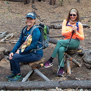 Jane and Mary find the perfect campsite (although the chair seats are a bit hard). [photo by John] |
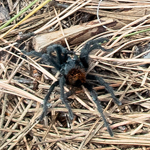 We almost squash this little guy on the trail. [photo by John] |
 Parting view of Sycamore Canyon. [photo by John] |
 These huge oak trees are at the peak of their fall colors. [photo by John] |
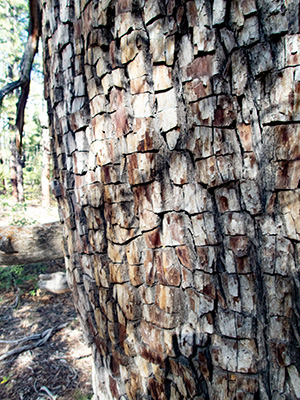 The bark of this tree certainly lives up to its name. Care to hazard a guess? [photo by John] |
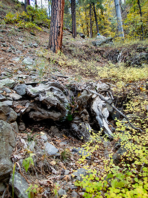 Fossilized remains of a crocodile or a dinosaur? [photo by John] |
|
With one last push, we finally break out on the rim of Sycamore Canyon at the Dorsey Trailhead and take a short rest break. From here, we’ll hike relatively easy and level Forest Service roads all the way back to the Kelsey Trailhead where John’s Jeep JL awaits us. Our only remaining challenge will be a few rough patches of road to navigate. We make one more left turn onto FR538G and begin hiking northwest through a forest of towering ponderosa pines and large oak trees in various stages of fall color. We’re also keeping an eye on the sky, as ominous-looking storm clouds have been threatening to open up and pound us from time to time. |
 Chuck and Terry hoof it down the last stretch of road. [photo by John] |
 Dark storm clouds are rolling in. [photo by John] |
|
By 4:00 PM we’re all back at the Jeep—safe and sound, and hungry enough to eat boiled boot leather. A quick check of my backpack thermometer shows a cool and comfortable 55 degrees. The temperature never rose above 60 degrees all day. And, oddly enough for a typically busy Saturday on the trails, we never saw another hiker on the trail for the entire hike. Many of the more well-known and popular trails that we hike are literally becoming overrun with hordes of hikers to the point of extreme trail overcrowding and potentially dangerous conditions, which ruins the experience for everyone involved. While lesser-known trails and especially those more challenging to access, like the Kelsey-Dorsey Loop, see very few hikers. But speaking of boiled boot leather, as hungry as we are I’m not sure if any of us could actually handle that. It would be just a bit too hard on the digestive system. But we’re certainly in the mood for some good Mexican food. So, per John’s suggestion, once back in Flagstaff we head straight for Salsa Brava. According to John, one of the best salsa bars in all of Arizona. |
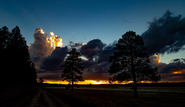 Fire in the Sky. Spectacular sunset shot from FR538G. [photo by John] |
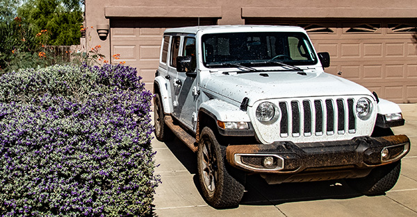 John’s Jeep JL, proudly sporting a fresh coat of FR538G mud and dirt. [photo by John] |
|
It’s been another perfect day for hiking northern Arizona’s unique high country and somehow, someway we’ve managed to dodge the weather bullet once again. Ironically enough, I said the exact same thing after our 2014 Kelsey-Dorsey hike. So now I’m wondering if I should tempt fate and go for a third Kelsey-Dorsey hike in the future. Probably not. Nevertheless, this is definitely a good hike to at least keep simmering on the back burner for a while. |
 Top of Page
Arizona Trailblazers Hiking Club, Phoenix, Arizona
Comments? Send them to the AZHC .
updated November 1, 2018