Outdoor Links
Hike Arizona
Trip Planning Guide
Trip Report Index
Calendar of Events
Library
|
AZT 25 White Rock Mesa Day Hike Pine November 17, 2018 by David French |
|
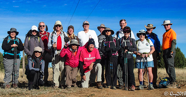 Trailblazers on Hardscrabble Mesa. [photo by Quy] |
| Tamar, Rebecca, Li, Tom, David T, Quy, Debbie, Michael, Bill, Kevin, Mimi, Dwight, Monika, Laurie, Dave F, Terry |
|
This hike was on AZT Passage 25, White Rock Mesa. According to the USGS topo maps we started on Hardscrabble Mesa and I found no references to “White Rock Mesa” on the maps. The sign to turn off Fossil Creek Road west of Strawberry says Hardscrabble, so Hardscrabble it is. |
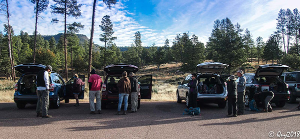 Consolidating cars at Pine Trailhead. [photo by Quy] |
|
Twelve Trailblazers met at Target in Fountain Hills before 7 AM and loaded into four cars. We drove to Payson where we met four more Trailblazers in one car. We drove to the Pine Trailhead, dropped one car, and 16 of us loaded into four cars and drove to the Twin Buttes Trailhead on Hardscrabble Mesa. It was a bright sunny day, with very little wind but the temperature was in the 40s. Quy took the group photo and we started up the rocky road under the power line. We started at elevation 5950 and climbed to just over 6200 foot elevation, and then descended to Oak Spring at elevation 5200. |
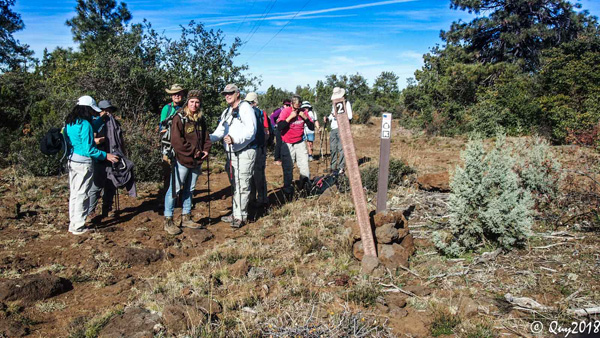
 Twin Buttes Trailhead. [photo by Kevin] |
 Getting ready to hike on Hardscrabble Mesa. [photo by Kevin] |
 Is everybody ready? [photo by Tom] |
|
For the first 3 miles or so, the trail was an old road used to build and maintain the power line. It was very rocky with lots of loose round rocks that made for challenging hiking. |
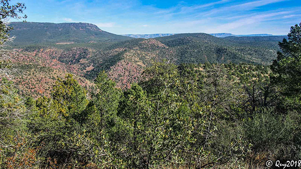
 Heading east on Hardscrabble Mesa. [photo by Quy] |
|
The vegetation consisted of grasslands and scrubby pinion pines at the beginning, but evolved into much taller pines and junipers and lush vegetation as we descended toward Oak Spring. We did enjoy a little fall color but not nearly as good as when Chuck led us from Pine Trailhead to Oak Spring and back a few years ago. At about the 3 mile point, we had departed from the power line. The temperature had warmed a bit, and most of us took off a layer of clothing. As we descended toward Oak Spring, we got some great views of the Rim in the distance and the hilly countryside west of Pine. We stopped for lunch at Oak Spring, which was actually flowing to keep the water tank full. The other wildlife tanks we passed all had quite a lot of water from the October rains. Nice to see. |
 Time to shed a layer. [photo by Quy] |
 The Mogollon Rim and Milk Ranch Point come into view. [photo by Quy] |
 The blue hour. [photo by David T] |
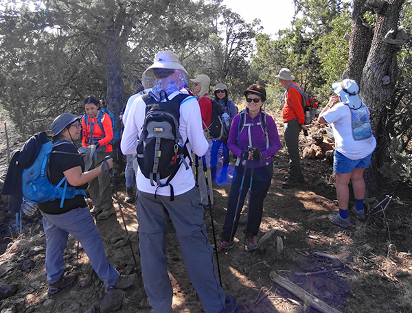 Let’s talk this over. [photo by Dave F] |
 Now let’s do the Twist. [photo by David T] |
 A muddy mess. [photo by Quy] |
 Just passing through. [photo by Kevin] |
 Merrily, merrily, down the trail we go. [photo by Quy] |
 Bradshaw Tank. [photo by Li] The other hikers walked the half mile to THAT Brewery at the south edge of Pine, where they set up two tables to serve us. The drivers returned shortly and we enjoyed some warm food and cold beer. We sat in the patio so most hikers retrieved their jackets from the cars or packs. On the way home we were treated to a beautiful sunset. |
 Oak Spring has water for the livestock. [photo by Kevin] |
 Grass on the climb out of Oak Spring. [photo by Kevin] |
 Hunter camper. [photo by Li] |
|
The hike was 10.9 miles long and took 5:30 hours. We ascended 1450 feet and descended 1990 feet. |
 Top of Page
Arizona Trailblazers Hiking Club, Phoenix, Arizona
Comments? Send them to the AZHC .
updated November 20, 2018