Outdoor Links
Hike Arizona
Trip Planning Guide
Trip Report Index
Calendar of Events
Library
|
Little Elden Loop Hike Flagstaff September 23, 2017 by David French |
|
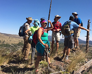
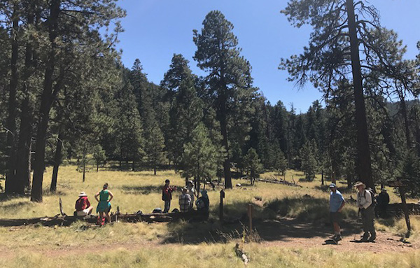
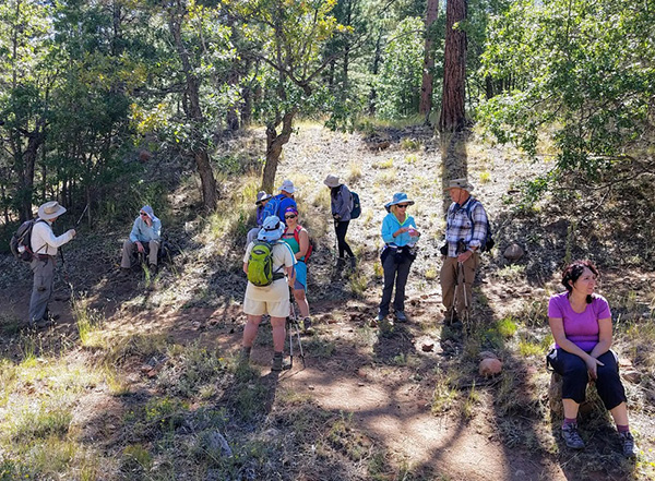
 Larry, Li, Debbie, Tom, Billie, Heather, Dave M, Scott, Biljana, Michael, Dave F, Katherine, Ralph, Laurie |
|
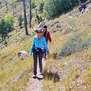
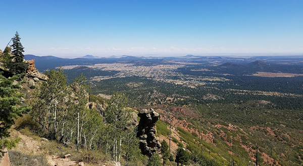
The weather made a rapid change late in this week, with temperatures in Phoenix 10 degrees or more below average and the temps in Flagstaff dropping to near freezing at night. After a long summer, the change was welcomed. Eleven hikers met at Bell and I-17, loaded in three cars and headed north on I-17. Thanks to Billie for getting everyone signed in and the carpools organized. They stopped by Munds Park to pick me up and we met two other hikers at the turn off to FR 556 from US 89. A two mile drive west on FR 556 brought us to the Elden-Horse Camp trailhead. We took a group photo and headed west on Little Elden Trail (also the Arizona Trail). After about 1.3 miles, we came to the junction with the Little Bear Trail and took a left. This hike is located on the northern slope of Mount Elden where the Shultz fire occurred a few years ago. The lower portion was not affected by the fire so there were lots of tall ponderosas to provide shade. The temperature was probably in the 40s at this time, so shade was not needed but it is always nice to hike through a forest. |
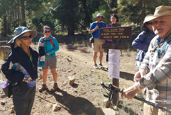 Getting ready to rumble. [photo by Tom] |
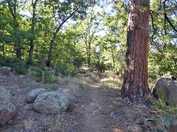
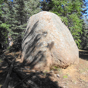 Boulder on the Little Elden Trail |
 The reforestation effort. |
 Pausing on the Little Elden Trail. |
 Little Elden and Little Bear junction. |
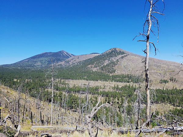 View of burn from Little Bear. [photo by Tom] |
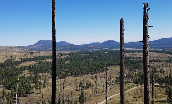 Ghosts of trees past. [photo by Tom] |
 Taking a break in the burn area. [photo by Li] |
 Pause among the ghosts. [photo by Li] |
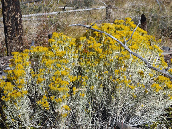 Flowing Bush on Little Bear. [photo by Larry] |
|
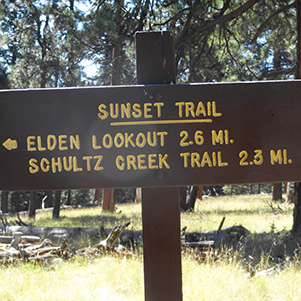
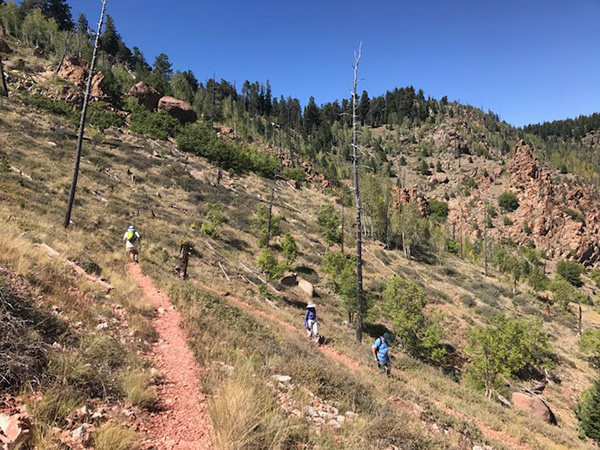
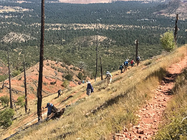
The Little Bear Trail was realigned after the fire and is much longer than it used to be. The signs say it is 3.5 miles from Little Elden to Sunset trail. The uphill grade is gradual but steadily upward. We passed through a major burn area where the ground cover was 2 or 3 feet high and black tree trunks stood like ghosts. The absence of trees gave us great views of the hills and mountains surrounding us and opened views of some rock outcroppings. The Forest Service is trying to re-grow the forest with small pine trees about 3 feet high growing out of cones to keep the deer from eating the young saplings. |
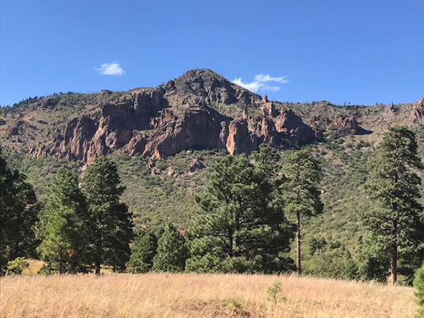
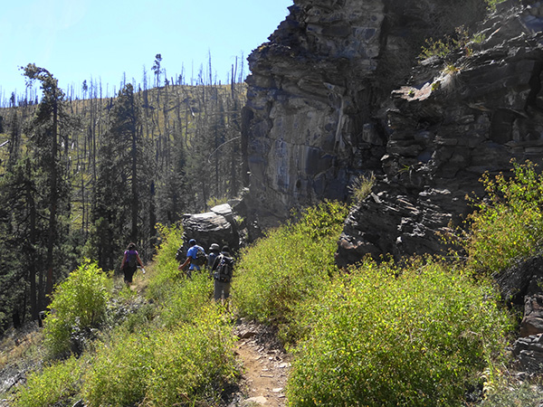 Cliffs galore. [photo by Tom] |
 Hikers make their way beside the cliffs. [photo by Tom] |
|
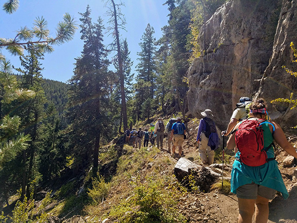
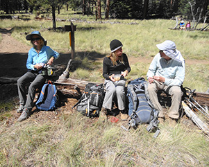
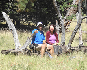
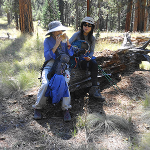
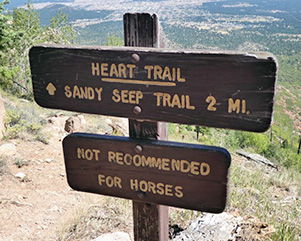
We reached the junction with the Sunset Trail and found some nice logs to sit on for our snack break. Most people were most happy to sit in the sunshine instead of seeking shade as we usually do. After a short break, we headed up the Sunset trail climbing all the way. When we reached the junction with the Heart Trail we had reached our highest elevation. We paused to make sure everyone made it and then headed down the steep rocky Heart trail. The Sunset Trail was through a nice forest, but the Heart Trail is all in the open from the burn and just because it is steep and rocky. We could see fall color emerging on the north side of Mount Elden just below the towers. We dropped over 2000 feet in 2 miles on the Heart Trail. The steep rocky trail offered some challenges, but everyone made it OK. |
 Snack Break. [photo by Tom] |
 Snack Break at the junction. |
 Snack Break. |
 Snack Break. |
 Snack Break. |
 Trudging up Little Bear [photo by Tom] |
 Little Bear Sunset Trail junction. |
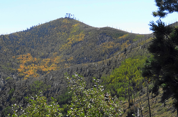 Autumn color on Mt. Elden. |
|
At the junction with the Little Elden Trail (AZT passage 32), again we waited for everyone to get down the Heart Trail, and then headed northwest for 1.8 miles to the trailhead and our cars. This part of the trail is rolling and welcomed after the big climb and rapid descent on the Heart Trail. We had hiked over 8 miles and our legs felt it. There is an old round concrete tank at the junction of Little Elden and the connecting trail to the trailhead. Otherwise, the connecting trail is not marked. We could see our cars through the forest so everyone made that last turn without incident. |
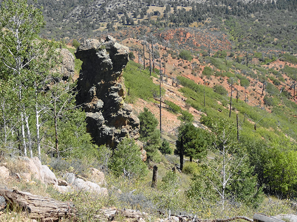 Hoodoo on the Heart Trail. |
 Doney Park in the distance. [photo by Tom] |
 Switchbacks: good for your heart. [photo by Ralph] |
 Winding down the Heart Trail. [photo by Ralph] |
 View to the north from the Heart Trail. [photo by Ralph] |
 Pausing at Heart - Little Elden junction. [photo by Tom] |
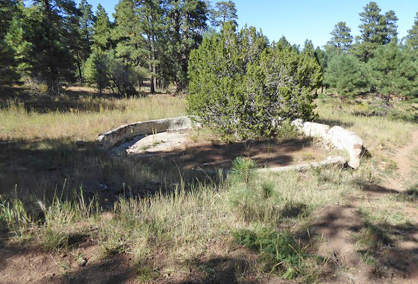 Old cow tank at the junction of the Little Elden and the connecting trail back to the trailhead. |
 Little Elden Trail back to the trailhead. [photo by Larry] |
 Sunset Heart Trail junction. [photo by Larry] |
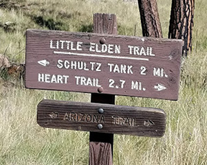 Heart - Little Elden junction. [photo by Tom] |
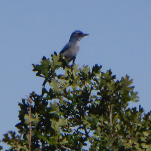 A bird in the bush is worth two in the hand. [Larry] |
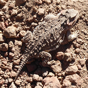 Horned Toad. [photo by Larry] |
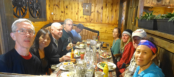 Lunch at the Horseman’s Lodge in Flagstaff. |
|
Five of the hikers headed for home. The other nine of us headed for Horseman’s Lodge Restaurant, located just south on US 89 and on the west side of the highway. I had called ahead so they had a table set up for us and provided good service, food and drink. We hiked a total of 10.5 miles with an elevation gain of 2300 feet. It took about 7 hours. |
 Top of Page
Arizona Trailblazers Hiking Club, Phoenix, Arizona
Comments? Send them to the AZHC .
updated September 30, 2017