Outdoor Links
Hike Arizona
Trip Planning Guide
Trip Report Index
Calendar of Events
Library
|
Flatiron Day Hike Superstition Mountains December 9, 2017 by Debbie Rowray and Tom Simonick |
|
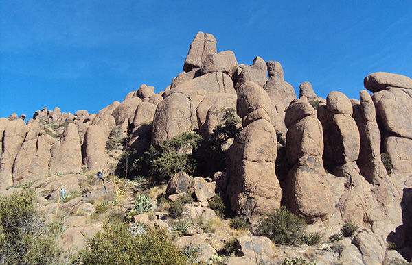
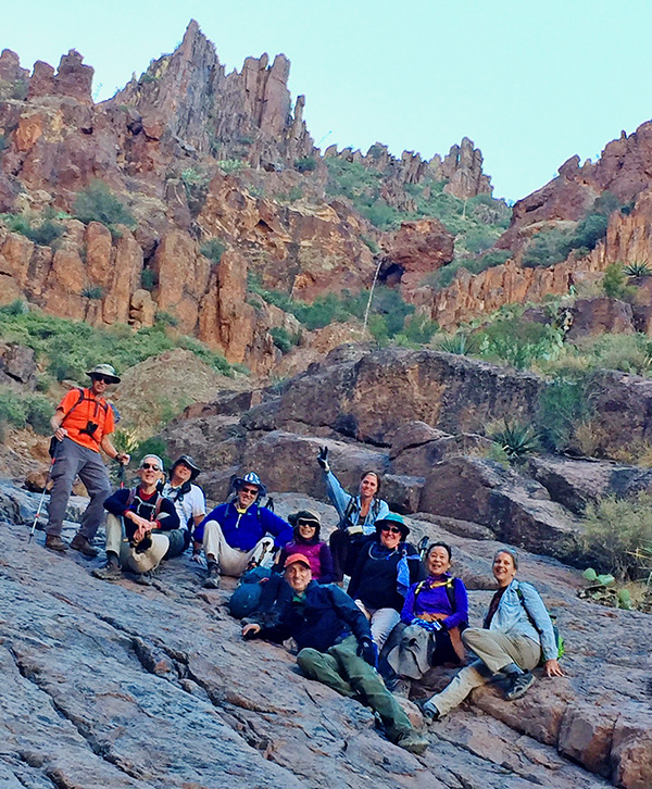 Flatiron, here we come! [photo by Mohammed] |
|
Front Row: Mohammed Second Row: Darrell, Tom, Michael, Mark, Li, Michelle, Carol, Janet Back Row: Debbie |
|
Seven intrepid hikers met at the Home Depot at Power Road and the Superstition Freeway and carpooled to Lost Dutchman State Park, meeting up with three more club members at the Siphon Draw Trailhead. After final administrative tasks and gearing up, we started hiking just before 9 AM. The weather was in the mid-forties, but the sky was clear, promising good viewing from the Flatiron. |
 The Siphon Draw Trail starts out easy. [photo by Tom] |
|
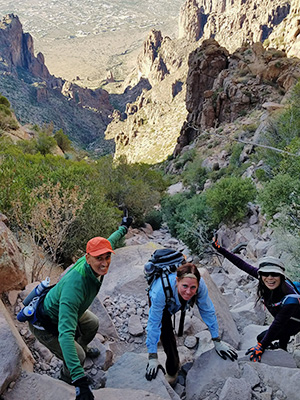
We warmed up hiking across the desert while getting a good view of the Flatiron, which comes with the realization of how much climbing we have to do to reach it. The trail began slowly climbing and at 1.8 miles from the trailhead we passed Thumb Rock, marking the entry into Siphon Draw Canyon. The trail continued to slope up and as we hiked we met other hikers, some going up and others already coming down from the Flatiron. The hikers coming down must have started really early and hiked fast to be that far down by 9:45 AM. The trail continues to ascend, until it reaches the official end in an area called the Bowl, located at the bottom of a waterfall. We congregated there for a group photo and began shedding clothing in preparation for the real climb ahead. |
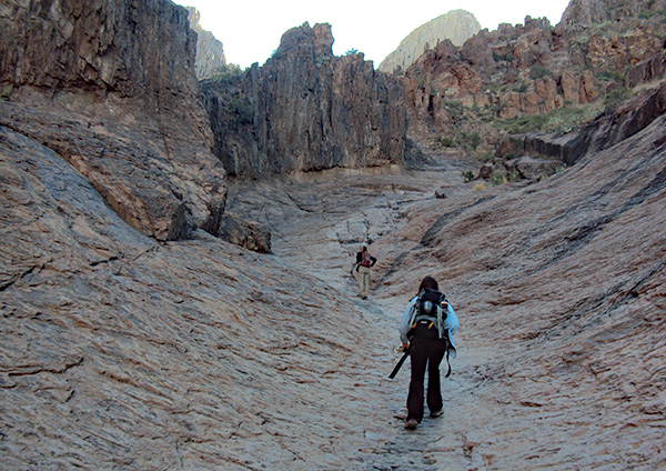
 Approaching Siphon Draw. [photo by Tom] |
 The Bowl. [photo by Darrell] |
 The Bowl is like climbing on a steep roof. [photo by Li] |
|
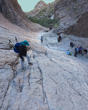
Everyone was reminded that if the route was in doubt, look for white dots or arrows. We’ll be ascending 1500 feet in about 1.5 miles! Leaving the Bowl is the first test, because the way up is steep and the rock here is very smooth. |
 Hikers on the way up. [photo by Li] |
We reached a very narrow rocky saddle and the Flatiron dominates the view. We then climb down near the top of the waterfall and continued up the canyon, alternating between hiking and scrambling, with more time spent scrambling as the ascent gets higher. It is hard work, but the views below get better with each 100 feet, and that means our objective is that much closer. |
 It’s a great boulder scramble. [photo by Tom] |
 Made it to the top! [photo by Darrell] On this hike, some of us choose a different route, turning left at the Wall and scrambling up the rocks on the left. It is a good route since it you can see where to place your feet and you don’t have to step out over the crevice. At the Wall, two members decided they had enough climbing for the day and returned to the trailhead. Michael assisted everyone who needed it to get over the Wall, and so eight hikers made it to the Flatiron. |
 What? You mean we’ll have to climb back down there? [photo by Tom] |
|
Once on the Flatiron, we joined the many other people there and walked to the west edge to enjoy the view and take a group picture. |
 The Magnificent Seven. [photo by Tom] |
|
The air was very clear and there were spectacular views in every direction. Leaving most of the crowd, we walked to the southwest edge to have a lunch and enjoy our success. |
 Lunch at the top of the world. [photo by li] |
|
The temperature was in the low seventies and the sun felt great as we regained our energy for an excursion to the 2011 plane crash site. Before leaving the Flatiron, we stopped by a group of hikers which were flying a drone and who Mohammed convinced to take a video of us. Maybe the video will show up on YouTube some day. One of the hikers was really relaxing, reclining in an inflatable chair. |
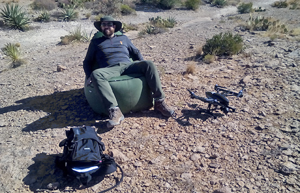 This chair is just right for arial photography. [photo by Debbie] |
|
We hiked off the Flatiron and some of us ascended to the low saddle to where the Superstition Ridgeline Trail ends. At this point, there was an idea to take another group picture, but some of us had enough of ascents for the day and began descending. Michael again stepped up and made sure everyone safely descended the Wall. Thank you, Michael! Meanwhile, five hikers, led by Mohammed, took a route up to the summit of Peak 5024, the highest point on the western edge of the Superstitions and about 400 feet higher than the Flatiron. |
 Hoodoos on the way to Peak 5024. [photo by Li] |
|
On the top of these hoodoos there are wonderful views in all directions including east towards Superstition Peak (5057 feet), essentially looking along the route of the Ridgeline Trail. |
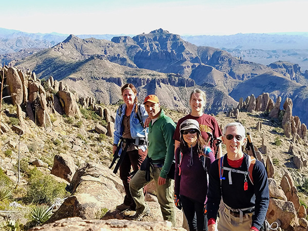 Trailblazers before the Superstition Ridgeline and Peak 5057. [photo by Tom] |
 A’down we go. [photo by Tom] |
After taking in the view, and meeting a lone hiker that we had run into all day, we climbed down to the saddle, preparing to begin the descent down Siphon Draw. However, one hiker had left their pack below the Peak 5024 summit and Mohammed gallantly made the climb back up to retrieve the pack. Meanwhile, thanks to our radios, we knew that Michael was still waiting at the Wall to help all of us get down it. After safely getting down the Wall, the six of us began the very steep climb down. Getting down from the Flatiron was pretty hard, because we were now scrambling on tired legs. On the plus side, we could continuously enjoy the beautiful views to the west; however you better focus on the next step down, least you go down and west too quickly. |
|
Climbing down took time, and by the time group of six made it back to the Bowl, it was almost 5 pm and the sun was really down. At the Bowl, we only paused long enough for a victory dance, and continued descending the trail, being careful not to hurry too much. |
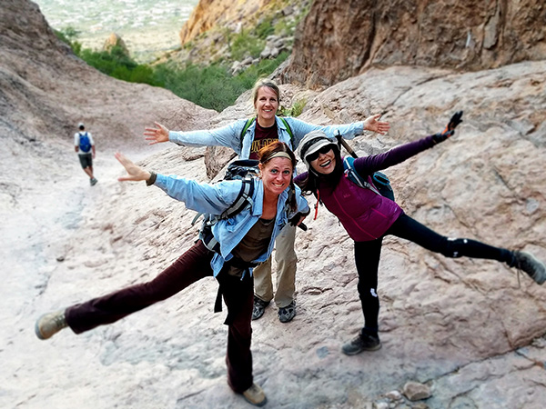 Dancing for joy! [photo by Tom] |
|
At sunset and we were out of Siphon Draw, still able to hike without lights, however, about a half mile from the trailhead it was dark and our lights came on. Reaching the trailhead without stumbling, we were surprised and really pleased that everyone had waited for our group. It was now 6:10 PM. Ten starving hikers wasted no time throwing their gear into cars and heading to the Hitching Post Pizza and Steakhouse only a couple of miles away. It was Saturday night and the place was packed, but we found two tables on the patio near an outdoor heater. |
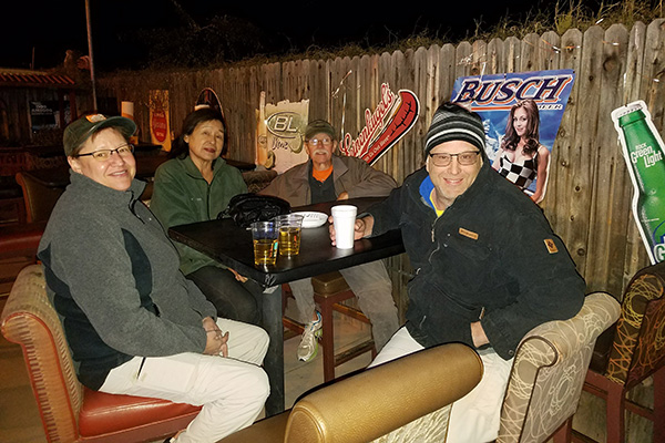 Let’s have a cold one. [photo by Tom] |
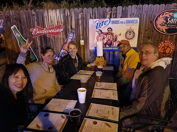 Now, you can bring on the food. [photo by Tom] |
|
Michael pointed out that if it was still daylight, we would have a good view of Flatiron. Dinner was good and the beer was cold while we stayed fairly warm thanks to the heaters. Debbie received a balloon “cobra” from the balloon man. A real surprise awaited us as Carol graciously paid for everyone’s dinner. Thank you very much, Carol! We said our goodbyes and headed back, having enjoyed a safe and exhilarating day of hiking. The official Club mileage for hiking to the Flatiron is 6 miles, with an elevation gain of 3000 feet. Tom’s phone app, which sometimes overestimates elevation and distance, recorded the hike, including the extra trek to the summit of Peak 5024, as 8.5 miles with an accumulated elevation gain of 4300 feet. The late group took 9 hours and 23 minutes to complete the hike. |
 Top of Page
Arizona Trailblazers Hiking Club, Phoenix, Arizona
Comments? Send them to the AZHC .
updated December 23, 2017