Outdoor Links
Hike Arizona
Trip Planning Guide
Trip Report Index
Calendar of Events
Library
|
Tule Canyon - Whitlow Loop Day Hike Superstition Wilderness April 7, 2016 by Bill Zimmermann |
|
 Jeff, Bill, Mike, Jeanne, Frank, Becky |
|
On a cloudy morning six hikers left Home Depot in two vehicles. We took the Florence exit off US 60. After a left turn at the stop sign we headed north under the overpass. An asphalt road took through West Queen Creek on our way to our exit at “RX1”. The plan was to drive the gravel road to end. Travel was bumpy and slow. We stopped short and decided to walk. After passing a locked gate the road ended at a the “4R Ranch Corral”. |
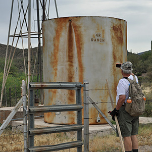 Water tower on the ranch. [photo by Mike] |
 Bill squeezes under the fence. [photo by Mike] |
 Wind power. [photo by Bill] |
 Now we’re going to bushwhack. [photo by Mike] |
 Bill finds the way. [photo by Mike] |
 Birds’ nest in a cholla is safe from predators. [photo by Mike] |
 We share the range with cattle. [photo by Bill] |
|
The cattle path (trail) we choose was taking us north up Whitlow Canyon. However, Bill wanted to do the loop clockwise. Bushwhack number one. We changed course and hiked toward waypoint “T1”. Back on track, we plodded our way up Tule Canyon. The heavy overcast did not provide the contrast for great scenic pictures. However, it saved our bacon as the temperature was rising. |
 Another fence to squeeze through. [photo by Bill] |
 Yes, I can see the way from here. [photo by Bill] |
 The rocks are like a staircase. [photo by Bill] |
 Our spring flowers are cholla blossoms. [photo by Mike] |
 Easy on those rocks! [photo by Bill] |
 A perilous descent into the canyon. [photo by Bill] |
 Mike snaps the award-winning cholla. [photo by Bill] |
|
We must have followed some wayward cattle as the path we took led us westward out of Tule Canyon. Disappearing path, a fence crossing, and getting warmer: they all contributed to slower group speed. It was obvious we would not be able to make the full loop as planned. Change of plans. We followed a draw to a saddle just north of peak 2528. From here we could see the wide-open Tule Canyon below. We climbed down crossing the canyon before heading up the east side ridge to “L” where we had lunch. |
 Finally, some good footing. [photo by Bill] |
 Teddy Bear Cholla. [photo by Mike] |
 Strawberry Hedgehog Cactus. [photo by Bill] |
 A cow watches us warily. [photo by Bill] |
|
We climbed up around the north side of 2662. After crossing another fence Bill said, “I hate to bust your bubble but we are not done climbing. By now Bill was on Plan C. He had hopes to get to the ridgeline at “R5” and follow it with view of Whitlow Canyon to the east. It was hotter and one of the hikers had no more uphill energy. Plan D. Down. We transferred some of the weight from their pack and headed down toward waypoint “T1”. The promised wind never showed. Back at the corral we met a rancher. Frank, our historian who volunteers at Superstition Mountain Museum, struck up a conversation. It was Manny Ruiz, the owner of 4R Ranch. He grew up working at the Quarter Circle U Ranch, starting at age 12. He pointed some nearby hieroglyphics that we checked out. |
 Manny tells us about the ranch. [photo by Mike] |
 The work of an ancient artist. [photo by Mike] |
 Let’s get out of here. [photo by Bill] |
|
Time to go. Bill headed up the road back to the vehicles. At the vehicles Bill’s GPS read 7.0 miles and 1090 feet. We finished in heavy air and 90 degree heat. I am not naming names but some hikers’ trips were a little shorter. Check the photo of Manny Ruiz and his smiling passengers. |
|
Supplemental Report by Frank Rutledge |
|
Besides being a cattleman, Manny Ruiz was a school teacher, and head basketball coach at Superior High School for over 30 years. He was born in 1933. Manny’s grandfather was a good friend of Tex Barkley and spent many an evening with Tex just sipping wine and talking. Manny worked for Tex Barkley when he was 12 years old. Manny’s dad bought Manny the rights to the Diamond R cattle brand, but Manny only uses the 4-R brand. The 4-R Corral is known as the metal corral. The Whitlow Canyon Cross, which was marked on the cliff near the corral, is called the Spanish Cross. According to Jack San Felice this cross is the second one he has seen in the Superstitions. Manny also says the ruins of an old rock house in in the canyon. Jack says in his book Superstition Cowboys that the Peralta Stone Maps lead into Whitlow canyon. Manny says there is an Indian ladder leading up the cliff face in the canyon that we did not see. Manny is a real Arizona cowboy. I got some of this information from Jack San Felice’s book. Manny told me the rest. Frank the Crank |
 Top of Page
Arizona Trailblazers Hiking Club, Phoenix, Arizona
Comments? Send them to the AZHC .
updated June 1, 2020