Outdoor Links
Hike Arizona
Trip Planning Guide
Trip Report Index
Calendar of Events
Library
|
Mount Elden Loop Flagstaff, AZ July 2, 2016 by Jim Buyens |
|
|
A week before this hike I was supposed to be the navigator on a hike around the Schultz Creek Loop in Flagstaff. Everything went fine until we got to the last junction before the Sunset Trail, and then I took a wrong turn. We got back to the trailhead with no problems but I still regretted missing that trail.
The club schedule had a C hike the next weekend but, wanting something more challenging, I pulled out my maps and there it was: The Sunset Trail! And by ascending 1300 feet in 4.7 miles, we could reach the always-spectacular Mount Elden Lookout tower!
Then I noticed that by returning on the Elden Lookout, Fat Man’s, Christmas Tree, and Little Elden trails, I could make the route my favorite configuration: a loop! The mileage added up to 13.4, which is on the high side for me, but I’d finished OK on the Schultz Creek Loop hike and that was 11.3 miles so why not?
A couple of times during the intervening week the Flagstaff weather forecast for Saturday reached 80% chance of thunderstorms all day. But by Friday evening to was down to 50% in the early morning and 30% in the late afternoon. I figured we’d miss the early storms and 30% chance of afternoon thundershowers is almost an everyday thing this time of year in Flagstaff. And thus it came to pass that six of us showed up at 6:00 AM and then headed north.
We did see thunderstorms over Flagstaff as we drove but they dissipated before we arrived. So after gearing up at the trailhead we started our hike under beautiful sunny skies.
 Jim, Bill, Carol, Scotty, Yanis, and Ken ready to go. [photo by Bill] |
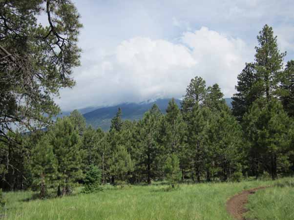
The Sunset trail rises fairly gently to the Mt. Elden summit. We definitely knew we were going uphill but no one had to struggle. I was keeping an eye on the weather but skies remained sunny the whole time. And the payoff came when we reached the summit, found the watchtower manned, and received permission to go up.
 The going was easy at first and everyone was in good spirits. [photo by Bill] |
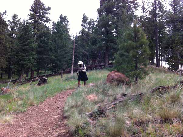 Here I am working my way up the Sunset Trail. [photo by Carol] |
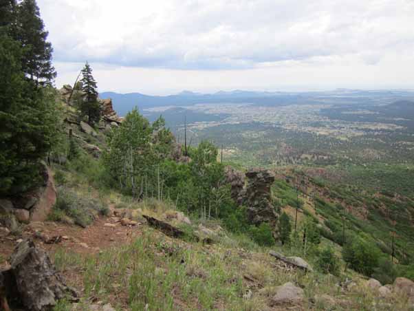
 A great view of the San Francisco peaks with their summits in the clouds. [photo by Scotty] |
 Heading up the final leg to the top of Mt. Elden. [photo by Carol] |
The view at the summit was, of course, spectacular, and the watcher was extremely friendly. He answered all the usual questions (“How many fires have you personally spotted?” “Have you even been in the tower during a lightning strike?” ...) and told us he’s been watching for 38 years!
Let me tell you how much I liked this watcher: I gave him a key ring!
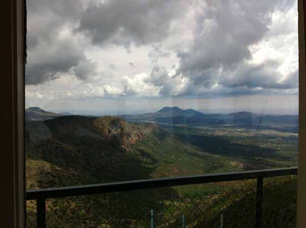 This is the view from inside the Mt. Elden watchtower. [photo by Carol] |
Then I noticed that while the map distance to the lookout was 4.7 miles, my GPS was showing a little over six. Uh-oh! At that rate, the thirteen-mile distance for the whole hike was looking more like sixteen! But nobody wanted to go back the way we came and so onward we pressed.
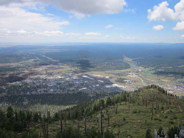 Here’s another view from the Mt. Elden watchtower. No thunderstorms in sight! [photo by Scotty] |
The Elden Lookout trail is much steeper than the Sunset trail: it falls 1800 feet in 1.4 miles! It’s very well built, though, with lots of stone steps, rail steps, and switchbacks. Reaching the bottom is still exhausting, though, and going back up must be quite a workout. (I’ve never tried it).
 Beginning our descent on the steep Elden Lookout trail. [photo by Scotty] |
 Continuing down the Elden Lookout trail. [photo by Bill] |
From there we connected to a mile of the Fat Man’s loop, continued for a mile and a half on the Christmas Tree trail, and then started up the Little Elden trail as our final segment back to the trailhead.
 Nearing the bottom of the Elden Lookout trail, the gray sky was from a thunderstorm moving in. [photo by Scotty] |
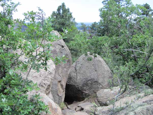 This is where the Fat Man’s Loop passes through the Fat Man’s Gap. If you can’t make it through, I guess you’re a person of considerable dimension. [photo by Scotty] |
 A low-hanging branch along the Fat Man’s Loop. [photo by Bill] |
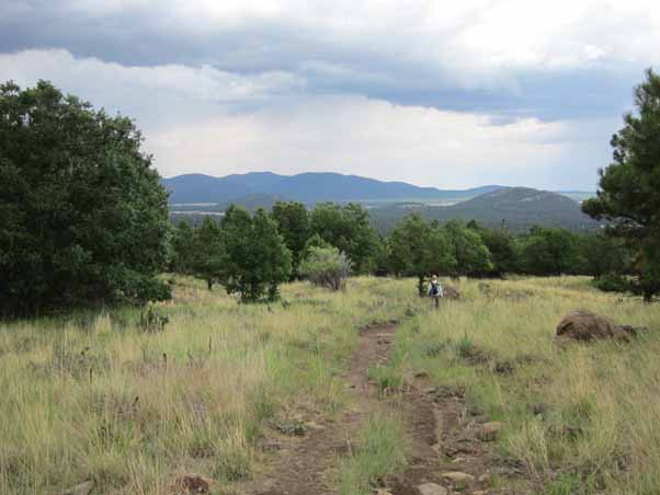 We’re on the Christmas Tree Trail here, working our way back to the trailhead. [photo by Scotty] |
It was after we started on the Little Elden trail that an afternoon thunderstorm moved in. It started out with pea-sized hail that nearly covered the ground in some places and then continued with a heavy downpour and lightning strikes. The trees quickly got so wet they were dripping as much as they were catching so we just kept going. We still appreciated the tall trees for blocking the wind, though, and we hoped that if a lightning bolt came it would hit one of them instead of us.
 Bill slogs through the muck after a thrilling thunderstorm. Buckets of rain, pea-sized hail, lightning. What more could anyone want? [photo by Carol] |
After what seemed an eternity the rain stopped and hiking pretty much returned to normal, except that all the flowers were blooming their utmost and the smell of the forest was invigorating. But on the downside, so to speak, the trail was often full of water. We always found ways around but my nearly-new supposedly-waterproof boots still filled up. Maybe it was water dripping off my legs and through my socks.
The final distance was 16.6 miles, not 13.4, and the total elevation was 3594 feet, not 2200. So much for trusting maps. But even so, we were all glad to have completed a great workout. Distance, altitude, sunny skies, fantastic views, storms, hail, lightning, muck: this hike had it all!
After pouring all the water out of our boots and shaking off our raingear we headed into town for a well-earned dinner. Yanis suggested The Museum Club on Route 66 east of Flagstaff. The building is a historic landmark built in 1931, and at one time it was the largest log cabin in Arizona. With a capacity of 300, it now plays host to both national acts and regional bands
We got there about 6:15, which is before the main action, so we didn’t have to pay a cover charge or buy concert tickets. The food was neither fancy nor five-star but it was good enough and we just wanted to eat.
Thanks to everyone who joined me on this hike. I certainly enjoyed being together and I sure we all finished with stories to tell. And as to the mileage, we clearly exceeded expectations! Great job!
Hmmm, now where to hike next week ...
| Hike Statistics | ||
| Total Distance: | 16.6 | miles |
| Starting Time: | 9:06 | AM |
| Moving Time: | 7:48 | hrs:min |
| Stopped Time: | 0:40 | hrs:min |
| Duration: | 8:28 | hrs:min |
| Finishing Time: | 5:35 | PM |
| Avg. Speed Moving: | 2.1 | mph |
| Avg. Speed Overall: | 2.0 | mph |
| Starting Elevation: | 7,996 | ft |
| Minimum Elevation: | 7,004 | ft |
| Maximum Elevation: | 9,332 | ft |
| Total Ascent: | 3,594 | ft |
| Calories: | 1,406 | |
| Starting Temperature: | 53 | ° |
| Finishing Temperature: | 65 | ° |
 Top of Page
Arizona Trailblazers Hiking Club, Phoenix, Arizona
Comments? Send them to the AZHC .
updated July 4, 2016