Outdoor Links
Hike Arizona
Trip Planning Guide
Trip Report Index
Calendar of Events
Library
Utah
October 8-13, 2016
by Lin Chao
|
33 people, 12 cars, 6 days, 5 nights, 2 National Parks, 2 Utah State Parks, 1 awesome trip. The drive - 8 out of 10. (10 for the scenery, but -2 for the long drive). Back hurts, legs almost numb. Next time we should travel with a big bus, or camp someplace where we do not have to drive eight hours. Campsite - 9 out of 10. It is a beautiful site, with lots of room, but the sloped areas were a bit challenging. We could easily add 10 more tents if we needed to. The view was awesome, but setting up the tents on a slope was a bit tricky. The soft sand was good for our backs, but it was not so fun to walk on when we were in a hurry. Campfire - 10 out of 10. (Rudy deserved at least 7 points, Jade got 1 point). Group potluck - 10 out of 10. The potluck helpers deserve an extra bonus if I could add it on. Weather - 9.5 of 10. (0.5 deducted for the gusty winds on the third night of our camping trip). Hiking trails - 9.5 out of 10. (For some of us, it is 10 out of 10, for some 9 out of 10, so the average is 9.5 if my calculator still works right). Fun - 10 out of 10. (Awesome!) |
|
First Day - Saturday, October 8, 2016 - Drive from Phoenix to Devil’s Garden Campground. On the early morning of October 8th, seven cars assembled at Bell and I-17, with just the lightest sprinkle of rain. With one car still on its way, we headed out to start our epic journey. |
 Meeting up in North Phoenix. Look up, Carl! |
|
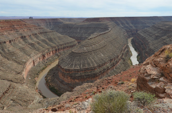
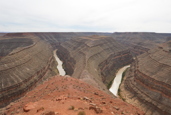
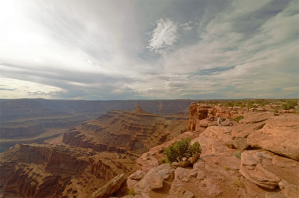
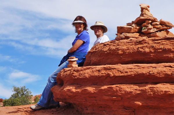
After a quick stop at the Sunset Rest Area to meet up with our last car, we arrived at Flagstaff for some much-needed breakfast, where we joined up with a few more cars. After some delicious but not so healthy food (go MacDonalds!), we are well on our way to Kayenta for some lunch. Our first scenery stop was Goosenecks State Park. We saw not only the gorgeous landscape of the Goosenecks canyons, but a little rattlesnake to welcome us in the parking lot. All the snake really wanted was some shade (i.e. hiding behind the front wheel of a van and terrifying the owners of said van), but after lots of anticipation and patience, he finally showed us his sideways line dance. |
The beautiful scenery of Goosenecks Canyon:
|
|
|
 Closer ... closer ... [photo by John S.] |
 Ahhhhh! Human! Slide away! [photo by John S.] |
|
Moab is only two hours away from Goosenecks State Park, but it’s been a long day on the road and a very certain someone is getting very bored in the back of the car by now. At around 6 PM we arrived at our campsite, a place we will call home for the next five days and nights. The sunset is beautiful, but everyone is too busy finding the perfect tent spot to take pictures. Night falls quickly as soon as the sun sinks below the horizon. The campfire is burning, and the laughter has just begun. It was a long day, but we all arrived safely. Jade’s version:Today’s been really boring. Sort of. I found out this morning that plastic containers of peanut butter cookies make decent umbrellas. And that no matter how many pillows you put next to you, the back seat never gets any more comfortable. And that it is possible to exhaust all your music albums. Even the classic rock ones. Snakes are the most adorable things you have ever seen. Well, this one was at least. It was the cutest thing and it was like “Ew, humans,” and it was sooooooo cute! Tent-setting is a two person job. Unless your tent is on a sandy hill under a pine tree next to someone else’s tent in Arches. Then it’s, like, a ten person job. Just kidding. Only like a two and a half person job. I was moral support. The campfire was fun. I got my face roasted off. But my sleeping bag was still cold, no matter how many things Mum stacked on top of my sleeping bag to make it warmer. So yeah. Today was pretty boring. |
 Found our campsite. |
 The fire is so delightful! |
|
Second Day - Sunday, October 9, 2016 - Devil’s Garden
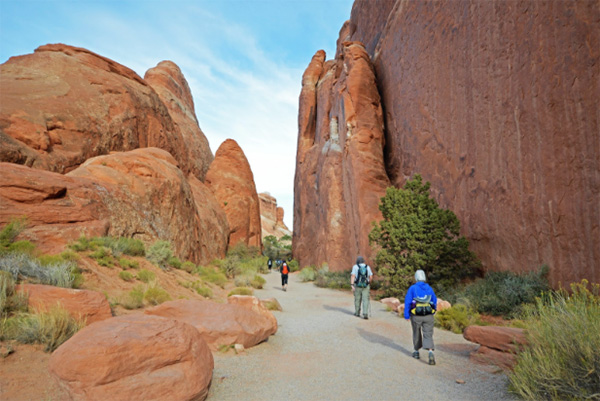
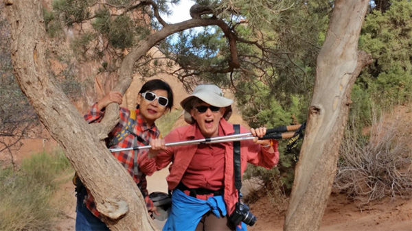
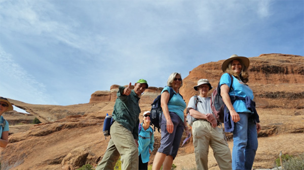
It is still dark outside, but some early larks are already up. Since Yanis and Vanessa came late last night, they decided that they would take the day off to recuperate. Wendy, Nancy, Carol, Gail, Susan, and Deb, all of whom stayed at Moab, met us at the campsite. After some quick bagels, muffins, and yogurt, after a few rounds of bell ringing, a quick introduction. By 8:30 AM, we are all ready to hike our very first hike, the longest of the maintained trails in the park: Devil’s Garden. With Michael at the vanguard, Chuck in the back sweeping up the stragglers, John R. and I in the middle, all thirty one of us, most still hyped up from coffee or tea, marched out to the Devil’s Garden trailhead. Well, that was my plan. Michael had a little warm-up for us instead, checking out the Broken Arch trailhead (in the completely wrong direction) before finally heading out to the Devil’s Garden trailhead. |
 Those early larks didn’t miss the sunrise. |
Is everybody here? And ready?
|

|

|

|
 The trailhead is that-a-way. |
 Devil’s Garden, here we come. |
|
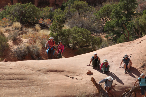
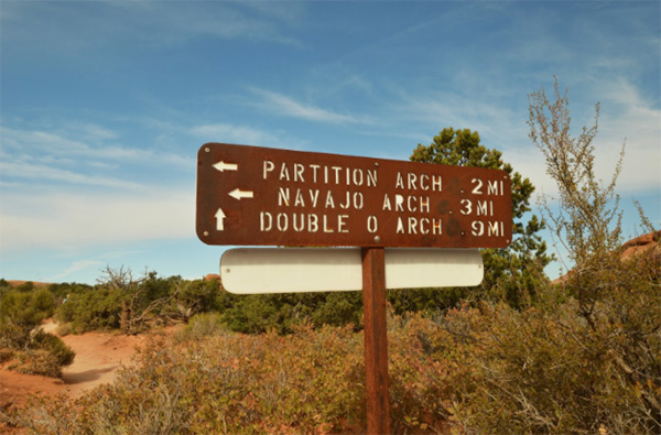
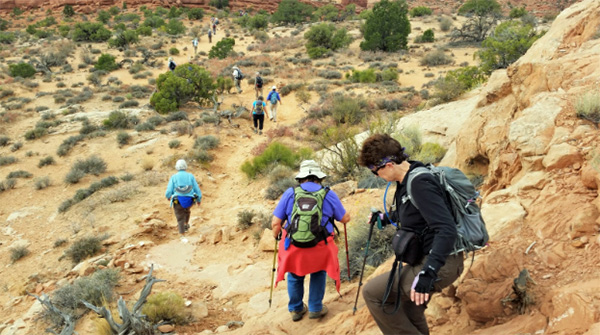
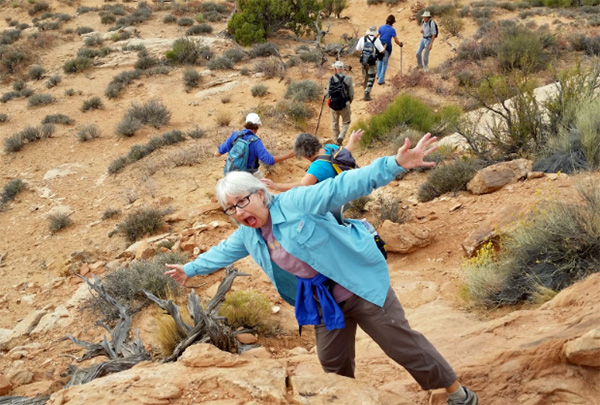
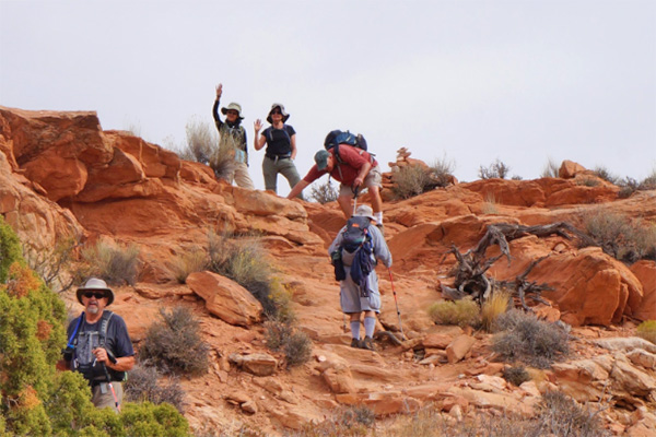
Devil’s Garden Trail leads to nine awe-inspiring arches: Tunnel Arch, Pine Tree Arch, Landscape Arch, Wall Arch, Partition Arch, Navajo Arch, Black Arch, Double O Arch, Private Arch, as well as the Dark Angel monolith and a trip through Fin Canyon. Just a quarter mile from the trailhead we encounter a side trail on the right, which leads to Pine Tree Arch and Tunnel Arch. We decide that we would check on this trail after we looped around through the Primitive Trail. One mile from the trailhead we saw our first and most important arch: Landscape Arch, which is 306 feet long and is one of the largest natural spans in the world. After a quick visit to Landscape Arch, John S., K.G., Joe, and Linda decided to turn back due to the steep slickrock and the primitive trail beyond. Twenty seven out of thirty one hikers continue on the trail well-marked with cairns. Not long after we started our climb up toward Fin Canyon, Jim, John R. and Dottie, and Monika M. decided that the safer route was back, and turned around to join John S., K.G., Joe, and Linda. Twenty three people continued on. A little more than a mile from the trailhead (1.2 miles to be precise), we encounter a side trail on the left, which takes us to Partition Arch and Navajo Arch. Navajo Arch is well-shaded and provides an excellent place for a quick break. After checking out these arches, we return to the main trail. Two miles from the trailhead we arrive at Double O Arch, which is a large arch stacked above a small arch. Here we stop and eat lunch. My plan was to go to the Dark Angel monolith afterwards, but there was a delay due to someone getting lost, so in the end we skipped it. We started off on the Primitive Trail, which begins directly after Double O Arch. Everyone was doing well, after recharging during lunch, until we got to a steep section of slickrock with a sharp drop-off on one side. Here several hikers, including Jade and me, turned back, not wanting to risk trying to get across. |
 All together, now. |
 When the saints go marching in |
 Sure, this is wide enough for my walking sticks. |
 Let’s amble on down the trail. |
 This seems like a good spot for a break. |
Are you ready for the big climb?
|

|

|
 Yes, we made it. |
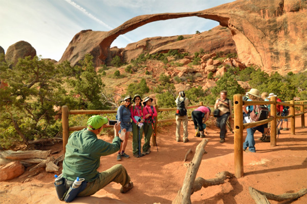
 Landscape Arch in the background. |
 Let’s admire the view here. |
Landscape Arch: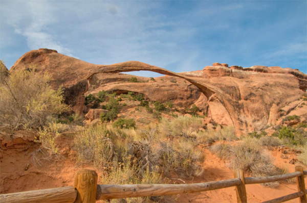
|

|
|
 Head for the Fins. |
 We’re on the straight and narrow. |
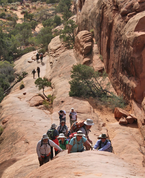 Up we go. |
 What a view! |
 It’s just as steep on the way down. |
 Walking to the sky. |
 Fins, but where’s the radiator? |
 Hmmm, this might be as far as I can go. |
 Sure, we made it. |
Trailblazers on a roll: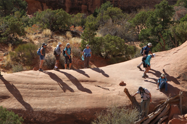
|
|
 I can do this any time. |
 King of the mountain. |
 Utah |
 Arches, everywhere. |
 Double O Arch. |
 Window on the world. |
 This arch is really big. |
 Let’s do the Twist. |
 This is so inspiring. |
 Onward and upward. |
 Follow me. |
 We’re not done with the Fins. |
 This looks like the trail to me. |
 Water in the desert. |
 This way to the Double O. |
 Desert varnish. |
 I’ll take the upper. |
 Peek-a-boo, |
 Don’t just be a lump on a log. |
 The rocks are more comfortable than they look. |
 We must be heading back to camp by now. |
 Watch your step. |
|
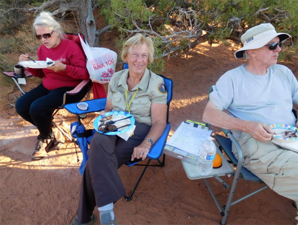
While my group of six hiked back to the campsite, those who had already arrived (i.e. Michael’s group) were busy preparing our AZ Trailblazers Potluck. Monika H., Dottie, Monika M., and Kim are diligently working to set up the tables and arrange all the dishes while everyone is warming up the food or cooking their dishes: John S. is busy grilling his world-renowned steak, Vanessa and Yanis are busy making meatloaf and mashed potatoes, Joe is cooking his beef stew, Rudy is singing his song while making his dish. What a happy camping sight in the beautiful late afternoon at the Devil’s Garden Campground! |
What a feast: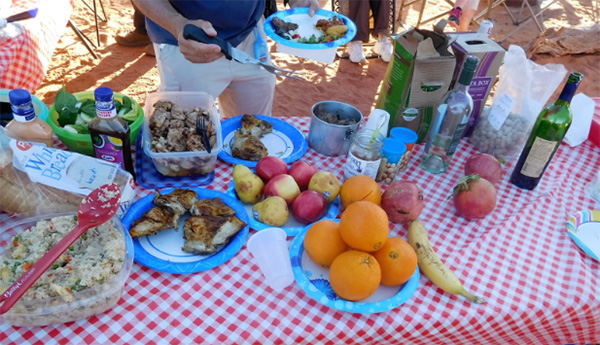
|

|

|

|

|
 Rudy likes ’em hot. |
 After this day of hiking, you’ve earned it. |
 Looking good there, Wayne! |
 Jade, Grill Master Supreme! |
 Bring it over here, Kim. |
 We just need to relax after a day like this. |
 There’s still plenty of food to go around. |
 This is the life! |
 The day is winding down at Devil’s Garden Campground. |
 A toast! |
|
At last, around 5 PM, our last three hikers returned safely back to the campsite. By then, the food was ready and we sure are hungry!
It was a tough hike today. We had planned to hike 7.2 miles, but most of us
ended up hiking 9 miles, with over 10 miles for a special few. I am glad
each and every one of us got back safely. |
|
Jade’s Version:
My feet hurt. And my legs. And my back. And my everything. But it was fun. Sort of-ish. We really have to learn how to stop taking detours. I’m a thirteen year old nerd whose best friend is a computer (not really). I am so not ready for all this intense hardcore stuff. I prefer less physically intense things. Like sleeping and stuff. One can be the loneliest number that you’ve ever heard in ten different languages! Mwahahahahaha! (P.S. Much apologies to the many hikers that may have been annoyed by me and Mary singing that uno was the loneliest number that you’ve ever heard) Steak is delicious. Especially the John S. kind. I am a Grill Master! I can cook German bratwurst and spicy Italian sausages! I can roast marshmallows to gooey perfection! I can ... wait, what else can I do? |
|
Third Day - Monday, October 10, 2016 Due to the tough hike yesterday, some people suggested that we take it easy to let our bodies and feet rest a bit. Sounds good to me too after I hiked more than eleven miles yesterday. After talking with a few leaders and rescheduling our reservation at the Moab Brewery, we decided we would have a light activity day and tour the nearby Canyonlands National Park and Dead Horse Point State Park. |
 Abandon boredom, all who enter here. |
 All together now at the Mesa Arch. |
 What a magnificent arch! |
 You can see part of the Canyonlands through the arch. |
 Grand View Point Overlook in the Canyonlands. What a view! |
|
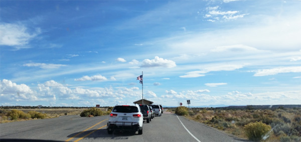
After a quick breakfast and a lunch-fixing session, we are carpooling in seven cars, with Wendy and her gang with two cars planning to meet us at the entrance to Arches National Park. After an hour of driving we arrived at Canyonlands. Wait, we are missing one car. My phone rings, it is Joe calling me. Andy and his crew (Joe, Mary, and Jade) are on I-70. They had missed the turn to Highway 313 after driving on Highway 191 and it would take them at least half an hour to turn around, so we decided that we would meet them at our second stop at Upheaval Dome. |
 Here we are, all together. |
 Upheaval Dome is thought to be an impact crater. |
 No one is sure about the mound in the middle. |
 La Sal Mountains, in the distance. |
|
In the meantime, the twenty nine of us drove to our first viewpoint: Mesa Arch. Mesa Arch is a short half-mile loop hike, which leads to the edge of a 500 ft. sheer cliff, dropping into Buck Canyon with the arch framing it all. We took a quick group picture (minus Andy and Co.), then headed off to our second viewpoint. We met up with Andy’s car at Upheaval Dome before hiking the 0.8 mile loop to the first viewpoint. Several people wanted to go to the next viewpoint while some wanted to head back down to eat lunch, so we split up with the one rule being that we had to meet up at the trailhead by lunchtime. After a delicious lunch in which many things were shared and eaten (pickles, spicy quail eggs, dates, the sorts), we split up by car to explore the park due to the limited parking spots at the viewpoints. Each car would follow their own schedule, visiting all the viewpoints on the way: Green River Overlook, Grandview Point Overlook, and White Rim Overlook. Although we all went our separate ways, we saw each other frequently at the viewpoints. The best view of Canyonlands is definitely Grandview Point Overlook. Of course, we, as AZ Trailblazers, would not miss this place. We spent a lot more time here than the other spots. Some decided to take the 2 mile hike, while others were too busy taking jumping pictures. Jumpmasters Lin and Jade set up shop, encouraging everyone to take at least one jump picture. After much deliberation, we decided that Ann was the best jumper, out of all of those who jumped, including Michael who jumped for the first time today. After stopping by the Visitor Center for a quick look around the gift shop and a bathroom break, we drove to Dead Horse Point State Park to take some pictures and enjoy the view. |
 Confluence of the Colorado River and the Green River. |
 What pretty clouds! |
 More clouds over the Canyonlands. |
 Wiry tree had a magnificent view. |
 I’m still standing. So there. |
 Do you think we might get some weather? |
 Take shelter where we can find it. |
 Not a double exposure. Those mountains are three-dimensional |
 Hairpin turns on the White Rim Road in Canyonlands. |
| Jumping for joy! | |

|

|

|

|

|
|
|
Dead Horse Point was the best State Park we saw on this trip, in my opinion. The gift shop was cool, the bathrooms were great, and the view? What can I say? Spectacular! There was a short mile-long rim hike, but by then it was starting to get windy, so we decided to head down to Moab for some showers and some nice warm food for dinner. |
 Enough adventure for one day? Let’s go have dinner. |
 Entrenched meanders at Dead Horse Point State Park. |
 The river carves its way through solid rock. |
 I’ve been here longer than you. |
|
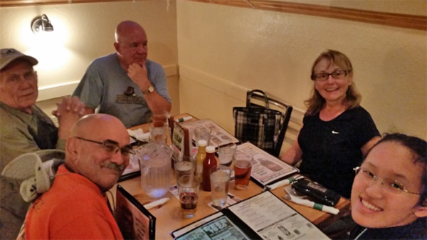
After several trips to the Moab Recreational Center to wash up and remove all the red sand from our pores, we gathered at the Moab Brewery for some food. The restaurant was very crowded. Thank goodness we made a reservation beforehand. We all posed for some pictures, then dug into our food. Unbeknownst to us, while we were enjoying our warm food and gelato for dessert, Mother Nature was wreaking havoc at our campsite. By the time we returned, the damage was done. |
 Just what we need. |
Trailblazers enjoying the repast:
|

|
|

|

|
|
A microburst had swept through our campsite while we were in Moab. Tents were flooded, tent poles snapped, rain flies blown away, canopies destroyed, wine boxes knocked over, cooking stuff strewn all over the campsite. Rudy’s canopy was a pile of cloth and metal, while John R. and Dottie’s had been neatly picked up and set down over a nearby juniper tree. There were even rumors of a mysterious yellow tent (Andy’s) flying across the road into someone else’s site. Thankfully, there were no injuries. So we did what any decent campers would do. Rudy got the campfire started, and everyone else got to work, using whatever means necessary that would ensure a good night’s sleep. One hour, four tarps, a roll of duct tape, numerous moving blankets, and many calories later, we finally repaired the campsite to at least working order. Everyone was tired, wet, and cold, so we all threw in the towel for the night. It was a good day of relaxing and enjoying the view. Not such a good day after cleaning up our campsite. |
|
Jade’s Version:
Everything still hurts. So I’m perfectly okay with this whole take-it-easy idea. Also, brownies are delicious. Thanks, Nancy. I have a thing against Canyonlands. It is a perfectly decent National Park, with federal funding and all, yet somehow they manage to not have flushing toilets. Really? I mean, come on. Dead Horse Point State Park is a State Park and they have flushing toilets. And a cafe. And a stuffed bighorn sheep, but that’s beside the point. Step up your game, Canyonlands. Get some flushing toilets. No proper car camping trip is complete without some proper classic rock to go along with it. I guess today it’ll be easy like Monday morning. Maybe I should open up a shop in Canyonlands, where I’ll charge people to take jumping photos and grill sausages and roast marshmallows. I think it’s a good idea. AZ Trailblazers get free service. Gelato is delicious. And it is never ever ever ever ever too cold for gelato. Ever. Fun Fact: Wind coming out of a canyon makes a giant whistling whooshy sound. Not good if you are either a light sleeper or scared of werewolves. Or both. Who knows? |
|
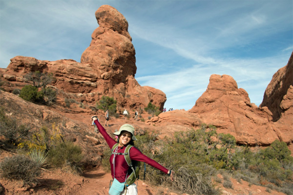
Fourth Day - Tuesday, October 11, 2016 Last night was a very interesting night. After we cleaned up the campsite, after about fifteen minutes of gusting wind, after a few hikers slept in the car, it was tough for all of us to get up and go hike on time. I decided then that we would give an extra hour for people to sleep in, for us to estimate the damage to our camp and find our missing canopy, plates, bottles, or whatever we couldn’t find last night. Today our first stop is at Tower Arch which is located in the remote Klondike Bluffs section of Arches NP. To get to Tower Arch, we need to drive on a dirt road for about 8 miles. Unfortunately for us, there was no sign showing us where we need to turn, so the overconfident Lin did not listen to the passenger driver Carl and kept on driving towards Delicate Arch with John’s Jeep trailing after us. After a few minutes, we finally realized our mistake, so we made a U-turn and with the help of John R., Dottie, and Carl, we finally found the dirt road. After making a right turn onto the dirt road, after passing through a gate, we are on our way to the junction. By the time we arrived at the signed junction, everyone else was there waiting for us. After a quick head-count (car-count? windshield-count?), we continued north on the main dirt road for an additional 50 yards to a second signed spur heading west (left). We followed the second spur road for a mile before arriving at the Tower Arch Trailhead. We are sort of behind schedule, so Wayne quickly herded us together for a group picture before we started hiking. |
 Who’s ready for hiking today? |
|
The entire route is pretty easy to follow if you watch for cairns used to mark the route. The route immediately climbs a short but steep ridge that requires some scrambling with knees, poles, or whatever you have. K.G. decided that she does not want to take the chance of hurting herself, so she turned back to the trailhead. The other 32 people, however, continued to climb and march on. After the beginning climb, the rest of the hike turned out to be pretty easy, with not much elevation gain. Our group soon reached the end and stopped for pictures and some snacks. |
 Let’s shoot a few pictures before we start. |
 Follow the trail up that hill. |
 Such a rocky passage. |
 It’s this way, you all. |
 Watch your step. |
 Oops! |
 This part of the trail is soft sand. |
 Yes, I think we’re getting somewhere. |
 What’s this? Chess pieces? |
 In the shadow of a mighty rock. |
 Wonderland of rocks and spires. |
 The great wall. |
 All together now, at the Tower Arch. |
 The perfect camera angle. |
 Under the arch, almost. |
 Petrified gearshift knob. |
 Tower Arch. |
 Window on the world. |
 Let’s take a break here. |
 The rocks are soft and cushiony. |
 Easy there. |
 We’re heading back. |
 Trailblazers on the rocks. |
 Hi there! |
 Yes, we did it. |
 Cairns with style. |
|
While most people sat under the shade of the arch, fearless Yanis climbed past the bottom of the arch to try to find the perfect camera angle. Wayne almost fell while taking our group picture, but thankfully didn’t. The view was spectacular. Since no one had been to Tower Arch in our group, it was a new experience for all of us. As much as we wanted to relax under the arch, we still had one more trail to finish, and everyone’s stomachs were growling by now, so we headed back. After we were back at the trailhead, everybody tailgated in the parking lot, trying to find the best position to properly enjoy lunch. After lunch, we left to go find our next destination: Delicate Arch. By the time we got there, the weather had changed. Black clouds were getting closer to the trailhead and the wind was picking up, but the fearless AZ Trailblazers pressed on (after grabbing some ponchos just in case). The Delicate Arch Trail is short, only a mile, but it has an eight hundred foot stretch of bare slickrock with no cover. I, as the leader, started to worry. If it rained, hiking up that slope would be a bad idea, especially if there was lightning. Thankfully, the weather cooperated (sort of), with only some relatively strong winds to “encourage” us. Finally, we arrived at the Delicate Arch. Some people only stayed long enough to snap a picture before heading back, while others stayed for more than half an hour, using every AZ Trailblazer photo pose in the book, from jumping to balancing on one leg to just plain smiling and waving their arms. At the arch, one lady asked us if we could take some pictures for her. Afterwards, we asked for her contact information so we could send her the pictures, and we found out her name was Lin, and that she was looking for some good hiking clubs in Arizona, so we invited her to join us. Three Johns, two Monikas, two Kims, so why not two Lins? |
 Why not two Lins? |
 Here, Chuck, have some. |
 Now there’s an odd place for a cairn. |
 All right, I’ve got the perfect shot. |
 Delicate Arch. |
 Delicate Arch. |
 Delicate Arch. |
 Utah is named for the Ute tribe. |
 Meanwhile, back at the trailhead ... |
|
After we went back to the trailhead, it was still early in the afternoon, so we decided that we were going back to the campground for our second round of potluck-ing. We dug out enough leftovers to feed an army, two elephants, and maybe a tiger or two, and dug into our food. The sunset was beautiful, and a few of us climbed up on the fins surrounding our campground to take some pictures and relax. Meanwhile, at the campfire, beer was opened, wine was shared, Arabic was learned, and laughter was spread. The stars twinkled, and watched over us as the night wore on. |
 The end of a perfect day. |
 Utah sunset. |
 Tenting tonight, on the old campground. |
 We’ll sleep well. |
 The Skyline Arch watches over us. |
 Taps. |
|
Jade’s Version:
It is cold and our campsite looks like an angry rhinoceros decided to lay waste to it, but nothing duct tape can’t fix, right? He he. Raise your hands if you think we all need some directions help! *raises hand* Why is Tower Arch called Tower Arch? It’s not even a tower! It’s just an arch. But then again, Arch Arch isn’t all that catchy of a name. Wind + Delicate Arch = recommended daily intake of iron in the form of sand in your eyes. Campfires! Marshmallows! |
|
Fifth Day - Wednesday, October 12, 2016 Today is our last day in the park. As tired as we are, there are still many places for us to go. The weather was beautiful, and after a quick breakfast, we were all eager to hit the road to check out the rest of the park. The first place we went was the Windows. We met at the Windows parking lot and took a quick group picture. Because all the places we were visiting today were viewpoints or overlooks with limited parking, we decided that each car would follow their own schedule. |
 All together now, one last time. |
 Let’s celebrate! |
 What a week this has been! |
 Derring-do, on the rocks. |
 Yes, that shadow is me. |
 Onesy. |
 Twosy. The North & South Window Arch. |
 Double Arch. |
 Park Avenue. |
 Tower of Babel. |
 Courthouse Towers. |
 Second View of Tower of Babel. |
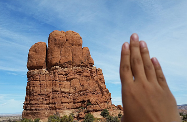 My hand is smaller, but can do more. |
 Come visit us again. |
|
We hiked the Windows first, then Double Arch, both of which were short hikes (0.5 mi round trip). At Double Arch, some brave adventurers climbed up to the arch and did some impressive poses once at the top of the arch. Some enjoyed relaxing in the shade. Some watched a group of kids from Moab draw the arch with their art teacher. Nicole, in her quest to get the perfect picture, slipped and lost traction on the slick sandstone, twisting her ankle. We all rushed over to make sure she was okay, but she was strong and said she was fine, so we helped her back down to the parking lot. After some emergency medical treatment from Dr. Jim, she insisted on driving and continuing on with the day. By now we are getting hungry and want a good place to eat our lunch. What better place to rest than the Garden of Eden Overlook? We found a place between two fins, with lots of shade and a little tiny (apple) tree to top it all off, and quickly devoured our lunch. While we were eating, a couple of brave adventurers were rock-climbing up the fins with all their gear and ropes. By then John S.’s car had arrived, with Anne, K.G., and Wayne. We also learned a very interesting lesson about healthy sandwiches made by Anne. Specifically, those of the peanut butter and bacon variety. From here, everyone split up and went their separate ways. My car decided to take it easy and just drive around, seeing and taking pictures of all the different viewpoints. We stopped at Balanced Rock, the Visitor Center, Petrified Dune Viewpoint, Courthouse Wash, Park Avenue, and the La Sal Mountain Viewpoint. At Balanced Rock, we met John R., Dottie, Yanis, and Vanessa, and we all enjoyed the beautiful scenery together. We decided to go to the Visitor Center first, because Jade really wanted to get a Junior Ranger badge for her Arabic teacher and hiking partner. After forty five minutes or so of scrambling around trying to finish the booklet, we headed onto our next viewpoint, with the Junior Ranger badge firmly tucked into our bag. After a quick photo stop at the rest of our scheduled viewpoints, we headed back to the campground, where a very certain Junior Ranger badge was presented to a certain hiking club member with much great honor, pomp and circumstance. After a quick dinner, we all gathered around the campfire, and Jade’s Marshmallow-Roasting & Co. once again made the rounds, making sure everyone who wanted a marshmallow got one. At the very end of the night. |
|
Sixth Day - Thursday, October 13, 2016 Today is the last day of our camping trip. WOW — the end of our six days. Do we really need to pack to go home? Do we really want to go home? The answers are ... Here are my feelings regarding this trip, on our last day of camping: • I’ll miss your laughter and your food. • I’ll miss the sunrise and sharing a cup of coffee with you. • I’ll miss watching the sunset with wows and ohs. • I’ll miss the campfire and the marshmallows we roast. • I’ll miss the birthday song we sang to you. • I’ll miss the stories we share and the beer and wine we toast. • I’ll miss the hiking in action on the trails. • I’ll miss the victory we celebrate on the road. • I’ll miss the Windows, Tower, Delicate, Devil’s Garden, and Double O. • I’ll miss the fun, the challenges, the memories we hold. • I’ll miss the friendship that has grown and grown. Happy trailblazing, my friends! |
 Let’s start home. |
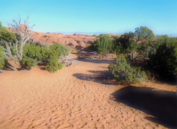 The picnic tables are empty now. |
|
Jade’s Version:
Can we just stay? For, like, ever? Packing takes too much work and I don’t really like school anyway. ... And the back of the car is uncomfortable. We should just stay. Set up permanent residence. Forward all mail to the Devil’s Garden Campground. Etc, etc. I’m sure most of you wouldn’t mind. Oh well. ‘Tis the end of an adventure. And hopefully the start of a new one. The Road goes ever on and on J. R. R. Tolkien, The Fellowship of the Rings |
 Top of Page
Arizona Trailblazers Hiking Club, Phoenix, Arizona
Comments? Send them to the AZHC .
updated December 25, 2019