Outdoor Links
Hike Arizona
Trip Planning Guide
Trip Report Index
Calendar of Events
Library
|
Whitford Canyon Day Hike Superior November 3, 2012 by Ted Tenny |
|
|
We assemble in east Mesa – 14 hikers, most of them members of the Arizona Trailblazers or the Arizona Outdoor & Travel Club. The first decision is who will go which direction on this key-exchange hike. “Whitford Canyon Trailhead is at a higher elevation,” Ted advises. We then organize into two groups, with the more ambitious hikers to start from Picketpost Trailhead led by George and Michael. Those who prefer a more leisurely pace and more downhill than uphill will accompany Ted and hike south from Whitford Canyon Trailhead. Each of the groups will need two cars. We all drive to the signed Picketpost turnoff from US 60 to exchange cars. The car exchange goes without a hitch. Two groups drive to their respective trailheads to begin hiking. Ted’s Report: Whitford Canyon Trailhead, South to Picketpost Trailhead |
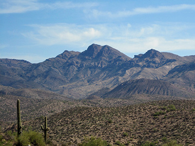
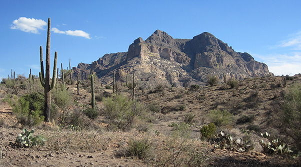
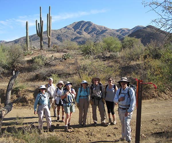 Ready for action, the southbound hikers stand before Peachville Mountain on FR 650. |
|
We start south the Arizona Trail, passage 18, as it crosses Forest Road 650 with Peachville Mountain in the background. Dan decides to return to the trailhead, leaving nine of us to continue walking south on the trail. |
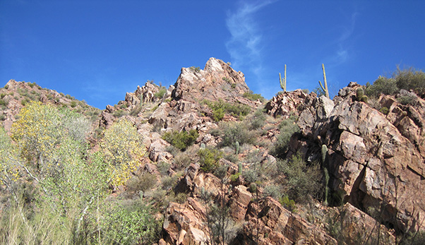 Scenically eroded canyon walls reach for the sky. |
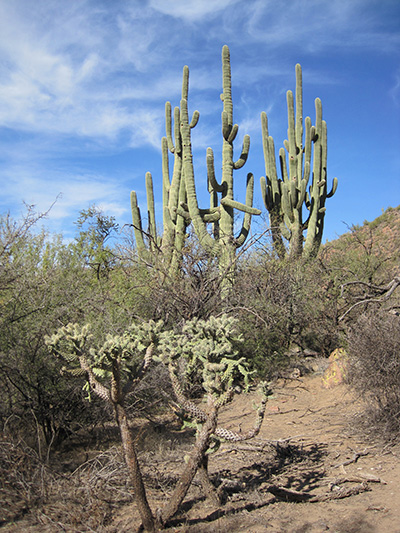
Championship saguaros of Whitford Canyon.
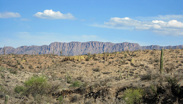
The map shows a zigzag on the west side of the canyon. Is it really there, or just an artifact of the track points recorded on a hiker’s GPS? We find out that it’s real, a steep descent back into the canyon after taking a detour on the west side. Whitford Canyon flows into Potts Canyon farther downstream. Before we get to the junction, the trail takes us across Whitford Canyon one last time to begin our gentle climb up to the ridge separating Potts Canyon on the west from Rice Water Canyon on the east. The views change dramatically, from the intimacy of Whitford Canyon to a series of wide open panoramas on both sides of the trail. |
 We’re through the gate. Now where are those northbound hikers? |
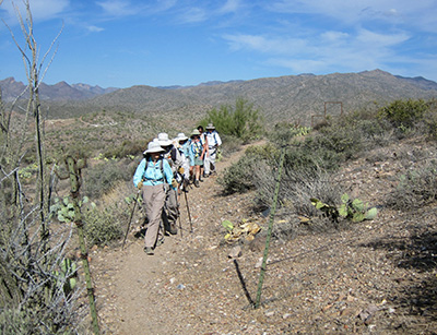
The climb is gradual as we cross several mining and ranching roads on our ascent to the ridge. The top is marked with a cattle gate, the first of many. Cattle enjoy this trail and have left many calling cards. |
 King’s Crown Peak, a major summit between Globe and Superior. |
GPS readings indicate that we are approaching the halfway point of our hike. Ted suggests that we should be meeting the northbound hikers soon, since they started earlier (a shorter drive to their trailhead) and presumably walk faster than us. “Let’s try those 2-way radios.” Both Ted and Peter try to contact them. Silence. |
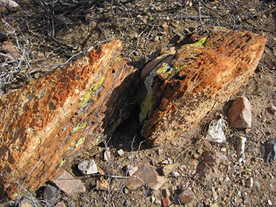 Brightly colorful rocks cheer us on. |
Well, they might have been delayed. We march onward, enjoying our first distant view of peak 5057 in the Superstition Mountains, and Weaver’s Needle. An unmarked fork in the trail causes temporary misdirection. We head over to the main trail as Ted walks back to remove some branches that were on it and replace them with a cairn. |
|
By now we’re well past the halfway point. This seems as good a place as any to stop for lunch, with some shade, boulders, and a sweeping view of the mountains to the west. Still no radio contact. Obviously our northbound companions are not on this trail. Something must have happened. All speculation is ended when we receive a radio transmission from Michael Humphrey. He explains that they were hiking on a different trail, now returning to Picketpost Trailhead. We all heave a collective sigh of relief. |
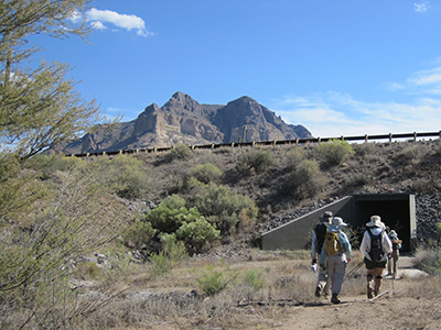 Hikers enter the tunnel, then emerge south of US 60. 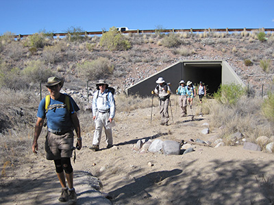
|
From the picnic area it’s mostly downhill to Queen Creek. The trail makes an easy descent from the ridge, crosses a wash, then flattens out as we approach the railroad tracks. The tunnel must be straight ahead. But here the trail goes west along the tracks and then along a fence line before angling west by southwest, for one more excursion into the foothills. Here we meet a most welcome sight: the northbound hikers! Instead of waiting around Picketpost Trailhead for us, then took the Arizona Trail north and through the tunnel so they could meet us on the trail. After a joyous reunion, we all walk down to Queen Creek by way of the tunnel under US 60. Ted sweeps for the last half mile, taking advantage of the photo-ops. |
 Hikers get closer and closer to Picketpost Mountain. |
 Apache Leap — a jump into history and legend. |
|
The hike is over, but we have two cars and one hiker back at Whitford Canyon Trailhead. Ted takes the drivers there, then we all return to Picketpost for one last farewell before heading home. |
 Top of Page
Arizona Trailblazers Hiking Club, Phoenix, Arizona
Comments? Send them to the AZHC .
updated October 7, 2017