Outdoor Links
Hike Arizona
Trip Planning Guide
Trip Report Index
Calendar of Events
Library
|
Needle Canyon Life March Superstition Wilderness November 27, 1999 by Ted Tenny |
|
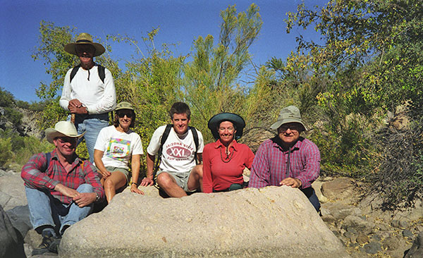 Anatoli, John, Marilyn, Ted Shauger, Linda, Ted Tenny |
|
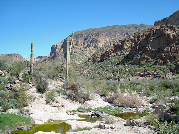
The map shows a dotted line through Needle Canyon between the Bull Pass Trail and the Boulder Canyon Trail. But when you get to Needle Canyon there’s no trail at all. So you have to bushwhack and rock-hop, remembering that if you stay near the streambed you’ll eventually get to the other end. Six hikers enjoyed the perfect hiking weather. Marilyn Gradowski, Ted Shauger and Sierra Club hike leader Linda Ramsey started from Canyon Lake, while Anatoli Korkin, John Helm, and Sierra Club-Motorola hike leader Ted Tenny started from Peralta Trailhead. Ted’s Report: Peralta Trailhead to Canyon Lake via Needle CanyonBirds are singing as we leave Peralta Trailhead at dawn on the Bluff Spring Trail. Geronimo Cave and Miner’s Needle stand out in the early morning sunlight. |
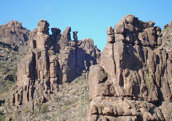 Rock columns, saguaros, and hoodoos mark the Bluff Spring Trail. |
|
After crossing Barks Canyon we catch our first glimpse of Weaver’s Needle, as John and Ted exchange stories about getting lost in this area. Bluff Spring Mountain comes into view in the east. It will be a magnificent sight for the next four miles. |
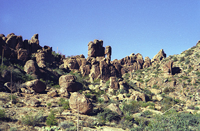 Bluff Saddle, a wonderland of fantastic rock formations. 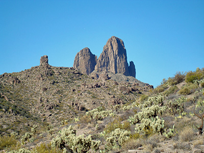 Weaver’s Needle is a triple volvanic plug of Miocene origin. |
Soon we are heading north on the Terrapin Trail. Bluff Saddle, 3420', is the high point of our trip, a wonderland of spires, balanced rocks, and window rocks, and the beginning of Needle Canyon. The trail crosses Needle Canyon six times before heading northwest for a spectacular side view of Weaver’s Needle. At Terrapin Pass we stop to rest, enjoying the fine panorama of Black Top Mesa and the mountains to the north. We are glad to be taking the steep grade north of Terrapin Pass going downhill in the cool shade of the morning. Our first radio contact with Linda’s party occurs as we are going west on the Bull Pass Trail toward Needle Canyon. Then we lose the signal and can’t re-establish contact until the two parties are 1/3 mile apart in the middle of Needle Canyon. |
|
Tall grass and cairns mark the place where the Bull Pass Trail crosses Needle Canyon. We leave the Bull Pass Trail and try to follow the route marked by a dotted line on the map, but soon find ourselves rock-hopping in the streambed. The descent is so gradual and the streambed so uneven that with no water it’s hard to tell you are going downstream. But we persevere, and soon meet Linda’s party for lunch in the middle of Needle Canyon. Everyone enjoys their picnic lunch as the leaders discuss which letter of the word “Needle” on the map we are closest to at this point. We take group pictures, then each party continues on the second half of their hike. |
|
A dotted line on the map bypasses the last, rockiest meanders of Needle Canyon and traverses a low ridge to get to the Boulder Canyon Trail. Ted is determined to find it. So we bushwhack, contouring around a steep, cactus-covered hillside to find our way west into Boulder Canyon. A white, needle-shaped rock marks the junction and gives Needle Canyon its name. |
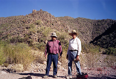 Ted and John at the junction of Needle and Boulder Canyons. |
|
The Boulder Canyon Trail crosses the streambed many times between Needle Canyon and the Second Water Trail, but we make good time. Everyone takes a big drink of water to start our last climb, 520' to the top of hill 2351 overlooking Canyon Lake. From the hilltop we make a quick descent to the Canyon Lake Trailhead. |
 When we see Geronimo Head we have 3 ½ miles to go. |
|
On the way we passed some folks camped in upper Barks Canyon, saw one hiker on the Dutchman’s Trail and one in Boulder Canyon. Otherwise we had the Superstition Wilderness all to ourselves from Peralta Trailhead to the junction of the Boulder Canyon Trail and the Second Water Trail. Then there were hikers and campers all along the Boulder Canyon Trail between the Second Water Trail and Canyon Lake. |
|
| Lessons Learned | |
| • | Hike the Needle Canyon route on a cool day, starting at sunrise. |
| • | Two-way radios are helpful when hike leaders going in opposite directions have to meet in the wilderness to exchange car keys. The topography of Needle Canyon limits their range, however. |
| • | Beware of the Needle Canyon cockleburs! Their seeds are the size of dimes but shaped like footballs, covered with spines that cling tenaciously to any part of your clothing or anatomy that they touch. |
| Acknowledgment | |
| Thanks to Linda Ramsey for helping me scout and lead this hike. | |
| This hike is described in Footloose from Phoenix by Ted Tenny, pages 178-191. | |
 Top of Page
Comments? Send them to the AZHC .
updated October 15, 2018