Outdoor Links
Hike Arizona
Trip Planning Guide
Trip Report Index
Calendar of Events
Library
|
Ballantine Trail Day Hike Mazatzal Mountains March 8, 2003 by Beth Baumert |
|
| Photographer: Chuck Parsons |
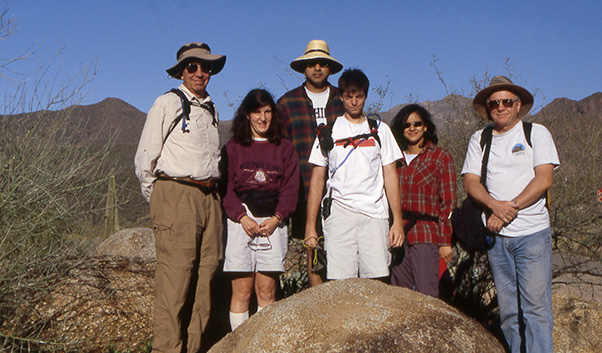 Left to Right: Mike, Beth, Richard, Matthew, Rochelle, and Chuck. |
|
Saturday started out rather coolly, but warmed up quickly, and we were blessed with clear blue skies and plenty of sunshine. We decided to take the south fork at the beginning and meandered uphill through a green forest of saguaros, prickly pear, barrel, and hedgehod cacti, along with staghorn cholla and teddy-bear cholla, as well as palo verde and ironwood trees. There were plenty of grasses and some wildflowers, and the brittlebush was blooming. Chuck pointed out a packrat’s den of dead branches. A few birds of prey soared mightily overhead, and we saw some lizards scampering off rocks after being interrupted from sunbathing. |
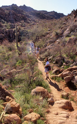 Hikers head down the Ballantine Trail. |
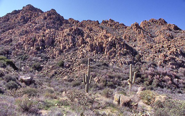 A sea of hoodoos along the trail. |
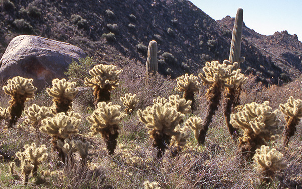 Backlit teddy-bear chollas. |
 Beth pauses before an impressive backdrop of saguaros, hoodoos, and boulders. |
|
As we descended toward the Ballantine trailhead, we could see snow-capped mountains in the Mazatzal Range. We could also see the creekbed far below us, and as we descended into a red-rock area in which the trail was moistened by underground flowing water, we were surrounded by fascinating hoodoo rock formations. Chuck and I availed ourselves of the opportunity to take photographs. We started uphill and upon our passing the “lookout” point with the fire ring, we saw a balanced rock to our right. We climbed up the hill and were rewarded with the sight of water in the creek. As we wound our way up past crumbling granite hillsides and more hoodoo formations, we reached a ridge with spectacular views on either side, and Chuck took a picture of the sunlit grove of “teddy-bear” chollas. They may look soft and inviting, but do not be deceived. You do not want to hug them. |
 The normally dry Camp Creek is flowing freely. |
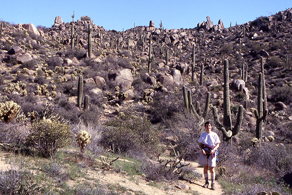
 Six hikers pause for another group picture opportunity. |
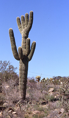 Beth’s favorite Ballantine saguaro, shaped like a hand. |
At the edge of the ridgeline, we turned toward the corner and saw a huge monolith rock balanced majestically on its perch. We then were delighted by the loud sound of water gushing in the creek. As we proceeded onward, we came to a four-fingered saguaro shaped like a hand, which Matt noticed and pointed out to the rest of us. We were actual witnesses to the water flowing in the creek and we passed over it, and after proceeding further, we came to the sign for Boulder Flats, telling us that we had traveled four miles. We then climbed up the mountain to our lunch spot with lovely views of snow and surrounding mountains. After lunch, we proceeded onward to seek the “lovely meadow” and creek that other hikers had described. We found both and came to the creek right at a small waterfall, which was pictureworthy. Chuck took another group photo as we walked back, at one very interesting rock formation. We walked back in the sunshine, enjoying the beautiful scenery and the breeze. Matt’s GPS told us that we went 10 miles. It was a very nice day with great company. |
 Top of Page
Arizona Trailblazers Hiking Club, Phoenix, Arizona
Comments? Send them to the AZHC .
updated March 11, 2018