Outdoor Links
Hike Arizona
Trip Planning Guide
Trip Report Index
Calendar of Events
Library
|
Wedding Cake Day Hike Superstition Wilderness February 7, 2015 by Andy Zaharchuk |
|
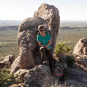
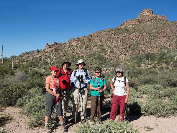 Becky, Michael, Andy, Eileen, Sana. [photo by Quy] |
|
Our Wedding Cake Hill hike started out on a pleasant morning, shortly after 7:00 AM, after gathering in the parking area at the east end of Cloudview Road. Six adventuresome Trailblazers participated–Sana, Becky, Eileen, Quy, Michael, and Andy. |
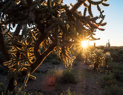 Sunrise from the chain fruit cholla. [photo by Quy] |
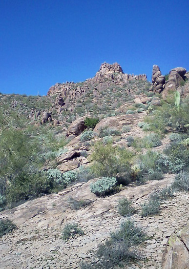
From the parking area, we hiked up the small hill to the fork in the trail, with the left trail leading to Hieroglyphic Canyon and right trail, i.e. the Lost Goldmine Trail, heading east toward Peralta. We turned right and followed the Lost Goldmine trail for a little over a mile, going up, going down, going over, and going through the several washes along our way. Then we came to some cairns pointing north and leading to the base of the Wedding Cake hill. |
|
Having pre-hiked this with Ted and his daughter Clara a few weeks earlier, I knew where to turn off of the mail trail. We proceeded on our bushwhack and soon reached a barbed wired fence, the Wilderness boundary, under which we all deftly crawled, and continued on our way. We approached the Wedding Cake hill from the southwest and began our climb. We climbed up from the southwest side and worked our way up, heading in a counterclockwise direction, until we reached the first “layer” of the cake. A very good view was to be had, even from this first so-called layer. We rested for a few minutes before our attempt to scale our way to the top. On approaching the base of the top layer, we were uncertain which way to go. All of us except Michael headed toward the west side, but it was soon apparent that the going this way would be very rough. Michael had decided to head around to the east side. |
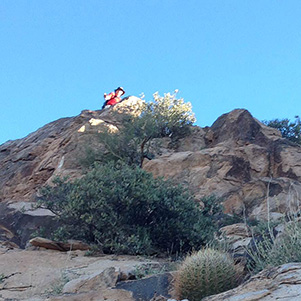 Michael reaches the top. [photo by Sana] |
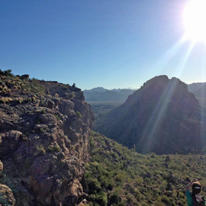 Turk’s head from atop WC. [photo by Sana] |
 Eileen finds a vantage point. [photo by Quy] |
 Becky admires Turk’s Cap Hill. [photo by Quy] |
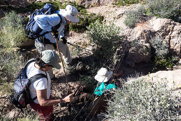 Easy does it! Eileen shows us how to get under that fence. [photo by Quy] |
|
While the rest of us were calling out for Michael (he was soon out of view), he had made his up to the very top, from where he could look down and see us (and we could likewise see him). Following his recommendation, the rest of us proceeded to follow his path up and counterclockwise along the east side. From there, it was a relative easy way to the crest. After reaching the top, we rested, snacked, and admired the view. After several minutes, we headed down by a different path, namely heading north and then east toward the wash between Wedding Cake Hill and Turk’s Cap Hill. There were stretches where the heavy brush made the going rough, but we all made it down safely. We soon came upon a road that led us to the Lost Goldmine trail, upon which we walked back to the trailhead. All agreed that it was a great hike on a great Arizona morning. We were back at the trailhead by about noon. |
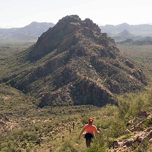
 Wedding Cake, from the east side. [photo by Becky] |
|
My thanks to all for participating and for sharing the photos taken and provided for this trip report. |
|
 Top of Page
Arizona Trailblazers Hiking Club, Phoenix, Arizona
Comments? Send them to the AZHC .
updated July 22, 2018