Outdoor Links
Hike Arizona
Trip Planning Guide
Trip Report Index
Calendar of Events
Library
|
Hill 2685 Day Hike Goldfield Mountains December 24, 2011 by Ted Tenny |
|
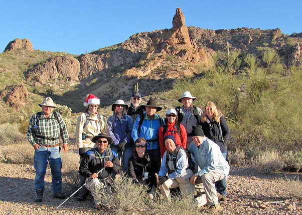 Ted, Wendy, Ajay, Debbie, Mark, Eileen, Rudy, Betty, Kathy, Andy, Bill, Suzanne [Bill Zimmermann photo] |
|
Perfect hiking weather was our gift on Christmas Eve in the southern Goldfields—bright and crisp with a gentle breeze. We started from the Idaho Access and walked east on the Wolverine Pass Trail, as it goes in and out of gullies just north of McDowell Road. A high arch overlooks the trail. As our trail gradually bends north we start to see pebbles of quartz on the ground. All of them have washed down from an outcropping on the hill above us. |
 High arch overlooks the Wolverine Pass Trail. |
 Dark Roadrunner hides from Coyote Rock. |
|
Parts of the trail are clearly marked by horse traffic. But then the equestrians seem to have gone a different way. The Wolverine Pass Trail is unmarked and becomes hard to follow as we approach a power line. Betty builds up cairns as Ted tries to see where the trail goes from here. Found it. We walk north to FR 10 and then through a valley that has been torn up by off-road vehicles. Mercifully, it doesn’t last. |
 “Frog Peaks” according to the giant petrified frog.  What a view the Trailblazers enjoy from Hill 2685! |
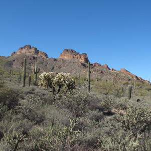
The dirt road dips down through a steep gully and then gives way to a horse trail to Bulldog Canyon. Ted first saw the trail eight years ago, coming down from an exploratory hike to Hill 2685. He had climbed up from the west side (definitely not preferred!), saw the trail and bushwhacked down to it. We leave the trail heading northwest to begin a moderate climb to the top of 2685. It’s off trail but not too steep. A mystery is solved on the way up. If you go to Tucson and visit the Fort Lowell Museum you can see N.C. McFarland’s 1883 map of Arizona Territory. Dome Mountain and peak 3269 are on the map, but they are called “Frog Peaks”. Why would anyone use a name like that? Well, with a little imagination you can see a giant petrified frog to the right of Dome Mountain. |
|
The view from the top is magnificent in every direction! Ted points out named and numbered peaks. “Dome Mountain is the only Goldfield peak named on the map,” he observes. “Others are known by their elevation above sea level, like peak 3269. But some of them have neither name nor elevation on the map, so we give them names, such as the Golden Dome.” “Re-convene at the horse trail,” he manages to say before everyone scatters on their way down. A big saguaro marks the top of the horse trail. Climb down then walk toward it and you’ll have a moderate descent. It’s a great day for hiking! We see a group of hikers on the unmarked road heading toward peak 3134, then two mountain climbers on the top of Peak 3269. A pair of Stearman biplanes sporting Army Air Corps insignia flies overhead. |
 Volcanic plugs rise from Bulldog Ridge to the west. 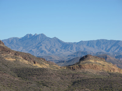 Four Peaks and Golden Hill 2726 to the east. |
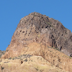 Mountain climbers made it to Peak 3269. |
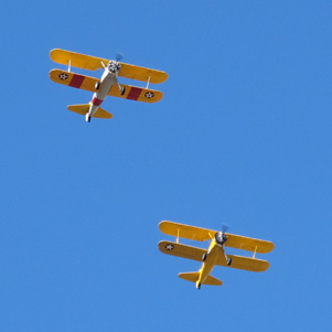 Nothing can stop the Army Air Corps! |
|
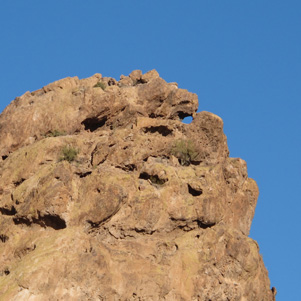
Down in the canyon we continue northwest on the Bulldog Canyon Trail and follow it downstream, usually on the south side of the canyon but sometimes on the bottom and sometimes on the north side. Ahead we can see a butte marked with foliated rocks and a cave. “It’s a short climb, but steep,” Ted advises. “Let’s go!” The Pyroclastic Arch is right next to the cave. Everyone climbs up to look around, then Rudy and Bill climb over to the Mask Arches while the rest of us return to Bulldog Canyon, our lunch stop. Rudy climbs a butte on the other side. |
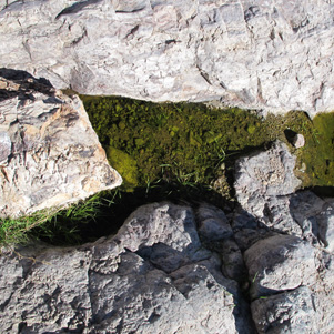 Colorful pool on our Pyroclastic climb. |
 The Pyroclastic Arch. |
 Eileen and Andy see the cave. |
 It’s a steep climb down for Andy, Kathy and Sue. |
 Cacti, Bill, and Mask Arches [photo by Bill] |
 Rudy climbs a butte overlooking Bulldog Canyon. |
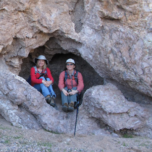 Debbie and Wendy at the cave north of 2315. |
 Wild, rugged Bulldog Ridge. |
|
There’s a trail on the south side of hill 2315, but we take the north side, climbing down waterfalls and looking for a way out of Bulldog Canyon south to FR 10. When we get to the road we take a detour to a curious metal structure. It’s a watering station, built to collect the runoff and keep local wildlife away from civilization. |
 Did we find wildlife at the watering station? |
 Coyote Rock casts a nostalgic look back. |
We then head south on the Idaho Pass Trail. It goes over an easy pass and then steeply down into an arroyo. The arroyo is good walking. A trail leads out of it on the right and over to McDowell Road, but this time we stay in the arroyo until a trail on the left takes us by Coyote Rock and then back to the cars. Thanks to everyone for a colorful hike to celebrate Christmas Eve, 2011. |
 Top of Page
Arizona Trailblazers Hiking Club, Phoenix, Arizona
Comments? Send them to the AZHC .
updated November 12, 2019